Audrieu geodata
Audrieu (Normandy) is a populated place; located in France in Europe/Paris (GMT+2) time zone. With population of 825 people, there are 10340 cities with bigger population in this country. Compared to other cities in France, 84.4% of cities are located further ↓South; 84.4% of cities are located further →East and 73.6% of cities have higher elevation than Audrieu. Note1
Administrative division(s):
- Level 1: Normandy
- Level 2: Calvados
- Level 3: Arrondissement de Bayeux
- Level 4: Audrieu


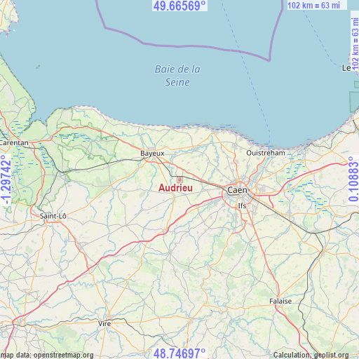
Audrieu GPS coordinates[2]
49° 12' 30.456" North, 0° 35' 39.444" West
| Map corner | latitude | longitude |
|---|---|---|
| Upper-left | 49.66569°, | -1.29742° |
| Center: | 49.20846°, | -0.59429° |
| Lower-right: | 48.74697°, | 0.10883° |
| Map W x H: | 102.2×102.2 km | = 63.5×63.5mi |
| max Lat: | 51.07786° ⇑15.6% North |
| Audrieu: | 49.20846° |
| min Lat: | ⇓84.4% South 41.3874° |
| min Long | Audrieu | max Long |
| -5.08615° | -0.59429° | 9.52242° |
| W 15.6%⇐ | ⇒84.4% E |
Elevation
Elevation of Audrieu is 70 m = 230 ft, and this is 123.7 m = 406 ft below average elevation for this country.
| Max E: |
2333 m = 7654 ft | 73.6% |
| Avg. | 193.7 m = 635 ft | |
| Audrieu | 70 m = 230 ft | |
Min E: |
-1 m = -3 ft | 26.4% |
See also: France elevation on elevation.city.
Geographical zone
Audrieu is located in North temperate zone (between Tropic of Cancer and the Arctic Circle). Distance of this North polar circle is 1929.7 km =1199.1 mi to North.| Distance of | km | miles | from Audrieu |
|---|---|---|---|
| North Pole | 4535.6 | 2818.3 | to North |
| Arctic Circle | 1929.7 | 1199.1 | to North |
| Tropic Cancer | 2865.5 | 1780.5 | to South |
| Equator | 5471.5 | 3399.8 | to South |


Nearby cities:
15 places around Audrieu: (largest is in red/bold)
• Bretteville-l’Orgueilleuse
5.8 km =3.6 mi,  86°
86°
• Cheux
6.9 km =4.3 mi,  133°
133°
• Creully
9.4 km =5.8 mi,  25°
25°
• Fontenay-le-Pesnel
4.3 km =2.7 mi,  165°
165°
• Grainville-sur-Odon
9 km =5.6 mi,  148°
148°
• Juaye-Mondaye
7.5 km =4.7 mi,  273°
273°
• Lantheuil
8.5 km =5.3 mi,  39°
39°
• Le Fresne-Camilly
9.6 km =6 mi,  53°
53°
• Noyers-Bocage
9.8 km =6.1 mi, 168°
• Rosel
10.1 km =6.3 mi,  77°
77°
• Rots
8.8 km =5.5 mi, 87°
• Saint-Manvieu
7.4 km =4.6 mi,  114°
114°
• Saint-Manvieu-Norrey
7.5 km =4.7 mi, 113°
• Saint-Martin-des-Entrées
8.6 km =5.3 mi,  318°
318°
• Tilly-sur-Seulles
4.3 km =2.7 mi,  212°
212°
Sources, notices
• [Note1] Compared only with cities in France existing in our database
• [Src1] Map data: © OpenStreetMap contributors (CC-BY-SA)
• [Src2] Other city data from geonames.org with taken over terms of usage.
• [Src3] Geographical zone / Annual Mean Temperature by Robert A. Rohde @ Wikipedia
