Aubergenville geodata
Aubergenville (Île-de-France) is a populated place; located in France in Europe/Paris (GMT+2) time zone. With population of 11,934 people, there are 809 cities with bigger population in this country. Compared to other cities in France, 78.8% of cities are located further ↓South; 58.8% of cities are located further →East and 83.4% of cities have higher elevation than Aubergenville. Note1
Administrative division(s):
- Level 1: Île-de-France
- Level 2: Yvelines
- Level 3: Arrondissement de Mantes-la-Jolie
- Level 4: Aubergenville


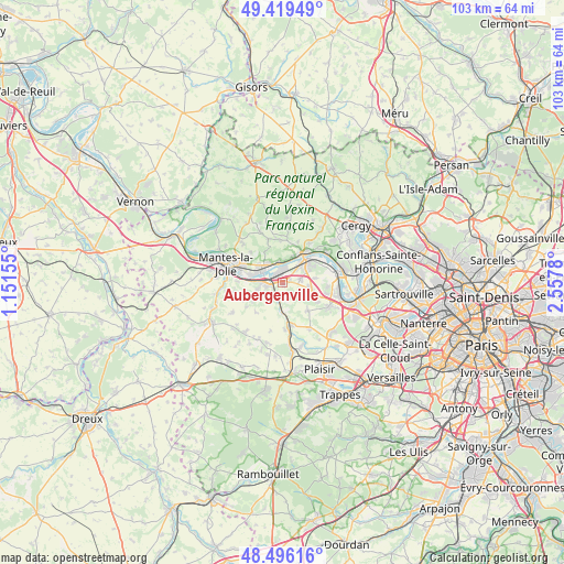
Aubergenville GPS coordinates[2]
48° 57' 35.856" North, 1° 51' 16.812" East
| Map corner | latitude | longitude |
|---|---|---|
| Upper-left | 49.41949°, | 1.15155° |
| Center: | 48.95996°, | 1.85467° |
| Lower-right: | 48.49616°, | 2.5578° |
| Map W x H: | 102.7×102.7 km | = 63.8×63.8mi |
| max Lat: | 51.07786° ⇑21.2% North |
| Aubergenville: | 48.95996° |
| min Lat: | ⇓78.8% South 41.3874° |
| min Long | Aubergenville | max Long |
| -5.08615° | 1.85467° | 9.52242° |
| W 41.2%⇐ | ⇒58.8% E |
Elevation
Elevation of Aubergenville is 46 m = 151 ft, and this is 147.7 m = 485 ft below average elevation for this country.
| Max E: |
2333 m = 7654 ft | 83.4% |
| Avg. | 193.7 m = 635 ft | |
| Aubergenville | 46 m = 151 ft | |
Min E: |
-1 m = -3 ft | 16.6% |
See also: France elevation on elevation.city.
Geographical zone
Aubergenville is located in North temperate zone (between Tropic of Cancer and the Arctic Circle). Distance of this North polar circle is 1957.3 km =1216.2 mi to North.| Distance of | km | miles | from Aubergenville |
|---|---|---|---|
| North Pole | 4563.2 | 2835.4 | to North |
| Arctic Circle | 1957.3 | 1216.2 | to North |
| Tropic Cancer | 2837.9 | 1763.4 | to South |
| Equator | 5443.8 | 3382.6 | to South |


Nearby cities:
15 places around Aubergenville: (largest is in red/bold)
• Aulnay-sur-Mauldre
3.5 km =2.2 mi,  196°
196°
• Bazemont
3.7 km =2.3 mi,  166°
166°
• Bouafle
3.4 km =2.1 mi,  81°
81°
• Ecquevilly
5.1 km =3.2 mi,  100°
100°
• Flins-sur-Seine
1.5 km =0.9 mi,  66°
66°
• Gargenville
4.4 km =2.7 mi,  314°
314°
• Juziers
3.5 km =2.2 mi,  351°
351°
• La Falaise
2.6 km =1.6 mi,  224°
224°
• Les Mureaux
5.3 km =3.3 mi,  48°
48°
• Maule
5.5 km =3.4 mi,  181°
181°
• Mézières-sur-Seine
4.5 km =2.8 mi,  271°
271°
• Mézy-sur-Seine
4.9 km =3 mi,  25°
25°
• Nézel
2.1 km =1.3 mi,  213°
213°
• Porcheville
5.6 km =3.5 mi,  284°
284°
• Épône
2.4 km =1.5 mi,  256°
256°
Sources, notices
• [Note1] Compared only with cities in France existing in our database
• [Src1] Map data: © OpenStreetMap contributors (CC-BY-SA)
• [Src2] Other city data from geonames.org with taken over terms of usage.
• [Src3] Geographical zone / Annual Mean Temperature by Robert A. Rohde @ Wikipedia
