Mézy-sur-Seine geodata
Mézy-sur-Seine (Île-de-France) is a populated place; located in France in Europe/Paris (GMT+2) time zone. With population of 1,892 people, there are 5048 cities with bigger population in this country. Compared to other cities in France, 79.7% of cities are located further ↓South; 58.4% of cities are located further →East and 85.9% of cities have higher elevation than Mézy-sur-Seine. Note1
Administrative division(s):
- Level 1: Île-de-France
- Level 2: Yvelines
- Level 3: Arrondissement de Mantes-la-Jolie
- Level 4: Mézy-sur-Seine


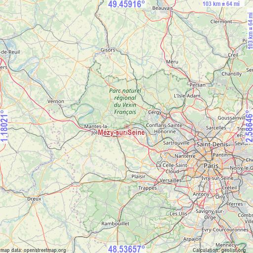
Mézy-sur-Seine GPS coordinates[2]
49° 0' 0" North, 1° 52' 59.988" East
| Map corner | latitude | longitude |
|---|---|---|
| Upper-left | 49.45916°, | 1.18021° |
| Center: | 49°, | 1.88333° |
| Lower-right: | 48.53657°, | 2.58646° |
| Map W x H: | 102.6×102.6 km | = 63.8×63.8mi |
| max Lat: | 51.07786° ⇑20.3% North |
| Mézy-sur-Seine: | 49° |
| min Lat: | ⇓79.7% South 41.3874° |
| min Long | Mézy-sur-Seine | max Long |
| -5.08615° | 1.88333° | 9.52242° |
| W 41.6%⇐ | ⇒58.4% E |
Elevation
Elevation of Mézy-sur-Seine is 40 m = 131 ft, and this is 153.7 m = 504 ft below average elevation for this country.
| Max E: |
2333 m = 7654 ft | 85.9% |
| Avg. | 193.7 m = 635 ft | |
| Mézy-sur-Seine | 40 m = 131 ft | |
Min E: |
-1 m = -3 ft | 14.1% |
See also: France elevation on elevation.city.
Geographical zone
Mézy-sur-Seine is located in North temperate zone (between Tropic of Cancer and the Arctic Circle). Distance of this North polar circle is 1952.9 km =1213.5 mi to North.| Distance of | km | miles | from Mézy-sur-Seine |
|---|---|---|---|
| North Pole | 4558.8 | 2832.7 | to North |
| Arctic Circle | 1952.9 | 1213.5 | to North |
| Tropic Cancer | 2842.4 | 1766.2 | to South |
| Equator | 5448.3 | 3385.4 | to South |


Nearby cities:
15 places around Mézy-sur-Seine: (largest is in red/bold)
• Aubergenville
4.9 km =3 mi,  205°
205°
• Bouafle
4.1 km =2.5 mi,  161°
161°
• Chapet
5.2 km =3.2 mi,  135°
135°
• Flins-sur-Seine
3.9 km =2.4 mi,  190°
190°
• Gaillon-sur-Montcient
3.9 km =2.4 mi,  18°
18°
• Gargenville
5.4 km =3.4 mi,  255°
255°
• Hardricourt
1.2 km =0.7 mi,  41°
41°
• Jambville
5.5 km =3.4 mi,  336°
336°
• Juziers
2.8 km =1.7 mi,  249°
249°
• Les Mureaux
2.1 km =1.3 mi,  115°
115°
• Meulan-en-Yvelines
1.9 km =1.2 mi,  62°
62°
• Oinville-sur-Montcient
3.9 km =2.4 mi,  320°
320°
• Seraincourt
4.1 km =2.5 mi, 343°
• Tessancourt-sur-Aubette
3.8 km =2.4 mi,  48°
48°
• Évecquemont
4.7 km =2.9 mi,  70°
70°
Sources, notices
• [Note1] Compared only with cities in France existing in our database
• [Src1] Map data: © OpenStreetMap contributors (CC-BY-SA)
• [Src2] Other city data from geonames.org with taken over terms of usage.
• [Src3] Geographical zone / Annual Mean Temperature by Robert A. Rohde @ Wikipedia
