Athis geodata
Athis (Grand Est) is a populated place; located in France in Europe/Paris (GMT+2) time zone. With population of 774 people, there are 10892 cities with bigger population in this country. Compared to other cities in France, 80.1% of cities are located further ↓South; 69.1% of cities are located further ←West and 70.5% of cities have higher elevation than Athis. Note1
Administrative division(s):
- Level 1: Grand Est
- Level 2: Marne
- Level 3: Arrondissement d'Épernay
- Level 4: Athis


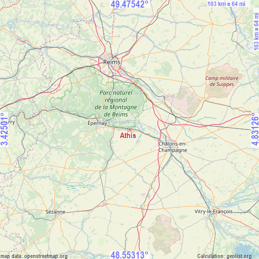
Athis GPS coordinates[2]
49° 0' 59.076" North, 4° 7' 41.268" East
| Map corner | latitude | longitude |
|---|---|---|
| Upper-left | 49.47542°, | 3.42501° |
| Center: | 49.01641°, | 4.12813° |
| Lower-right: | 48.55313°, | 4.83126° |
| Map W x H: | 102.5×102.5 km | = 63.7×63.7mi |
| max Lat: | 51.07786° ⇑19.9% North |
| Athis: | 49.01641° |
| min Lat: | ⇓80.1% South 41.3874° |
| min Long | Athis | max Long |
| -5.08615° | 4.12813° | 9.52242° |
| W 69.1%⇐ | ⇒30.9% E |
Elevation
Elevation of Athis is 77 m = 253 ft, and this is 116.7 m = 383 ft below average elevation for this country.
| Max E: |
2333 m = 7654 ft | 70.5% |
| Avg. | 193.7 m = 635 ft | |
| Athis | 77 m = 253 ft | |
Min E: |
-1 m = -3 ft | 29.5% |
See also: France elevation on elevation.city.
Geographical zone
Athis is located in North temperate zone (between Tropic of Cancer and the Arctic Circle). Distance of this North polar circle is 1951.1 km =1212.4 mi to North.| Distance of | km | miles | from Athis |
|---|---|---|---|
| North Pole | 4556.9 | 2831.5 | to North |
| Arctic Circle | 1951.1 | 1212.4 | to North |
| Tropic Cancer | 2844.2 | 1767.3 | to South |
| Equator | 5450.1 | 3386.5 | to South |


Nearby cities:
15 places around Athis: (largest is in red/bold)
• Ambonnay
7.5 km =4.7 mi,  25°
25°
• Avenay-Val-d’Or
8.3 km =5.2 mi,  315°
315°
• Avize
9.6 km =6 mi,  240°
240°
• Ay
10 km =6.2 mi,  295°
295°
• Bisseuil
4.4 km =2.7 mi, 318°
• Bouzy
7.2 km =4.5 mi,  11°
11°
• Chouilly
8.4 km =5.2 mi,  276°
276°
• Condé-sur-Marne
4.9 km =3 mi,  50°
50°
• Juvigny
9.9 km =6.2 mi,  88°
88°
• Jâlons
4.3 km =2.7 mi,  98°
98°
• Mareuil-sur-Ay
7.5 km =4.7 mi, 295°
• Matougues
8.7 km =5.4 mi,  106°
106°
• Oiry
5.6 km =3.5 mi, 278°
• Plivot
4.2 km =2.6 mi,  272°
272°
• Tours-sur-Marne
3.6 km =2.2 mi,  351°
351°
Sources, notices
• [Note1] Compared only with cities in France existing in our database
• [Src1] Map data: © OpenStreetMap contributors (CC-BY-SA)
• [Src2] Other city data from geonames.org with taken over terms of usage.
• [Src3] Geographical zone / Annual Mean Temperature by Robert A. Rohde @ Wikipedia
