Athée geodata
Athée (Pays de la Loire) is a populated place; located in France in Europe/Paris (GMT+2) time zone. With population of 514 people, there are 14947 cities with bigger population in this country. Compared to other cities in France, 57.3% of cities are located further ↓South; 87.7% of cities are located further →East and 78.6% of cities have higher elevation than Athée. Note1
Administrative division(s):
- Level 1: Pays de la Loire
- Level 2: Mayenne
- Level 3: Arrondissement de Château-Gontier
- Level 4: Athée


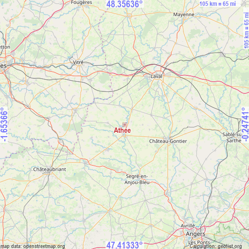
Athée GPS coordinates[2]
47° 53' 13.164" North, 0° 57' 1.944" West
| Map corner | latitude | longitude |
|---|---|---|
| Upper-left | 48.35636°, | -1.65366° |
| Center: | 47.88699°, | -0.95054° |
| Lower-right: | 47.41333°, | -0.24741° |
| Map W x H: | 104.9×104.9 km | = 65.2×65.2mi |
| max Lat: | 51.07786° ⇑42.7% North |
| Athée: | 47.88699° |
| min Lat: | ⇓57.3% South 41.3874° |
| min Long | Athée | max Long |
| -5.08615° | -0.95054° | 9.52242° |
| W 12.3%⇐ | ⇒87.7% E |
Elevation
Elevation of Athée is 58 m = 190 ft, and this is 135.7 m = 445 ft below average elevation for this country.
| Max E: |
2333 m = 7654 ft | 78.6% |
| Avg. | 193.7 m = 635 ft | |
| Athée | 58 m = 190 ft | |
Min E: |
-1 m = -3 ft | 21.4% |
See also: France elevation on elevation.city.
Geographical zone
Athée is located in North temperate zone (between Tropic of Cancer and the Arctic Circle). Distance of this North polar circle is 2076.6 km =1290.3 mi to North.| Distance of | km | miles | from Athée |
|---|---|---|---|
| North Pole | 4682.5 | 2909.6 | to North |
| Arctic Circle | 2076.6 | 1290.3 | to North |
| Tropic Cancer | 2718.6 | 1689.3 | to South |
| Equator | 5324.5 | 3308.5 | to South |


Nearby cities:
15 places around Athée: (largest is in red/bold)
• Astillé
11.3 km =7 mi,  40°
40°
• Ballots
7.3 km =4.5 mi,  278°
278°
• Bouchamps-lès-Craon
8.5 km =5.3 mi,  201°
201°
• Cossé-le-Vivien
7.2 km =4.5 mi,  23°
23°
• Courbeveille
12.6 km =7.8 mi, 21°
• Craon
4.5 km =2.8 mi,  178°
178°
• La Selle-Craonnaise
8.5 km =5.3 mi,  234°
234°
• Laigné
11 km =6.8 mi,  116°
116°
• Livré-la-Touche
1.3 km =0.8 mi,  251°
251°
• Marigné-Peuton
10.5 km =6.5 mi,  100°
100°
• Méral
8.5 km =5.3 mi,  343°
343°
• Pommerieux
8.1 km =5 mi,  151°
151°
• Quelaines-Saint-Gault
12.3 km =7.6 mi,  65°
65°
• Renazé
13 km =8.1 mi,  216°
216°
• Saint-Saturnin-du-Limet
12.1 km =7.5 mi, 226°
Sources, notices
• [Note1] Compared only with cities in France existing in our database
• [Src1] Map data: © OpenStreetMap contributors (CC-BY-SA)
• [Src2] Other city data from geonames.org with taken over terms of usage.
• [Src3] Geographical zone / Annual Mean Temperature by Robert A. Rohde @ Wikipedia
