Astillé geodata
Astillé (Pays de la Loire) is a populated place; located in France in Europe/Paris (GMT+2) time zone. With population of 575 people, there are 13746 cities with bigger population in this country. Compared to other cities in France, 58.6% of cities are located further ↓South; 86.9% of cities are located further →East and 58.3% of cities have higher elevation than Astillé. Note1
Administrative division(s):
- Level 1: Pays de la Loire
- Level 2: Mayenne
- Level 3: Arrondissement de Château-Gontier
- Level 4: Astillé


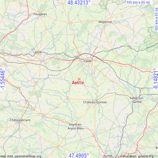
Astillé GPS coordinates[2]
47° 57' 48.456" North, 0° 51' 4.824" West
| Map corner | latitude | longitude |
|---|---|---|
| Upper-left | 48.43213°, | -1.55446° |
| Center: | 47.96346°, | -0.85134° |
| Lower-right: | 47.4905°, | -0.14821° |
| Map W x H: | 104.7×104.7 km | = 65.1×65.1mi |
| max Lat: | 51.07786° ⇑41.4% North |
| Astillé: | 47.96346° |
| min Lat: | ⇓58.6% South 41.3874° |
| min Long | Astillé | max Long |
| -5.08615° | -0.85134° | 9.52242° |
| W 13.1%⇐ | ⇒86.9% E |
Elevation
Elevation of Astillé is 107 m = 351 ft, and this is 86.7 m = 284 ft below average elevation for this country.
| Max E: |
2333 m = 7654 ft | 58.3% |
| Avg. | 193.7 m = 635 ft | |
| Astillé | 107 m = 351 ft | |
Min E: |
-1 m = -3 ft | 41.7% |
See also: France elevation on elevation.city.
Geographical zone
Astillé is located in North temperate zone (between Tropic of Cancer and the Arctic Circle). Distance of this North polar circle is 2068.1 km =1285.1 mi to North.| Distance of | km | miles | from Astillé |
|---|---|---|---|
| North Pole | 4674 | 2904.3 | to North |
| Arctic Circle | 2068.1 | 1285.1 | to North |
| Tropic Cancer | 2727.1 | 1694.5 | to South |
| Equator | 5333 | 3313.8 | to South |


Nearby cities:
15 places around Astillé: (largest is in red/bold)
• Ahuillé
6.5 km =4 mi,  348°
348°
• Athée
11.3 km =7 mi,  220°
220°
• Cossé-le-Vivien
4.9 km =3 mi,  246°
246°
• Courbeveille
4.2 km =2.6 mi,  319°
319°
• Entrammes
10.9 km =6.8 mi,  69°
69°
• Livré-la-Touche
12.4 km =7.7 mi, 223°
• Loigné-sur-Mayenne
12.7 km =7.9 mi,  142°
142°
• Marigné-Peuton
10.8 km =6.7 mi,  164°
164°
• Montigné-le-Brillant
5.7 km =3.5 mi,  28°
28°
• Montjean
9.5 km =5.9 mi,  299°
299°
• Méral
9.8 km =6.1 mi,  268°
268°
• Nuillé-sur-Vicoin
5.6 km =3.5 mi,  64°
64°
• Quelaines-Saint-Gault
5.1 km =3.2 mi,  131°
131°
• Ruillé-le-Gravelais
12.9 km =8 mi, 323°
• Saint-Berthevin
11.6 km =7.2 mi,  6°
6°
Sources, notices
• [Note1] Compared only with cities in France existing in our database
• [Src1] Map data: © OpenStreetMap contributors (CC-BY-SA)
• [Src2] Other city data from geonames.org with taken over terms of usage.
• [Src3] Geographical zone / Annual Mean Temperature by Robert A. Rohde @ Wikipedia
