Appoigny geodata
Appoigny (Bourgogne-Franche-Comté) is a populated place; located in France in Europe/Paris (GMT+2) time zone. With population of 3,137 people, there are 3103 cities with bigger population in this country. Compared to other cities in France, 57.1% of cities are located further ↓South; 64.5% of cities are located further ←West and 63.2% of cities have higher elevation than Appoigny. Note1
Administrative division(s):
- Level 1: Bourgogne-Franche-Comté
- Level 2: Département de l'Yonne
- Level 3: Auxerre
- Level 4: Appoigny


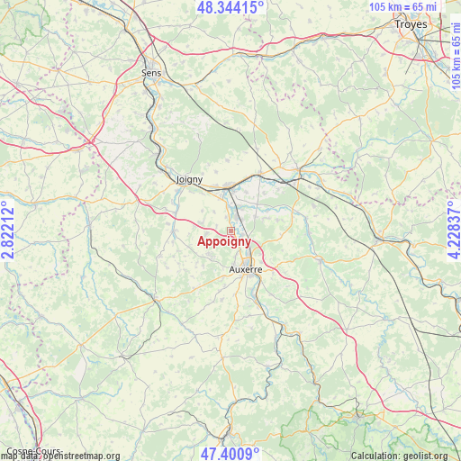
Appoigny GPS coordinates[2]
47° 52' 28.812" North, 3° 31' 30.864" East
| Map corner | latitude | longitude |
|---|---|---|
| Upper-left | 48.34415°, | 2.82212° |
| Center: | 47.87467°, | 3.52524° |
| Lower-right: | 47.4009°, | 4.22837° |
| Map W x H: | 104.9×104.9 km | = 65.2×65.2mi |
| max Lat: | 51.07786° ⇑42.9% North |
| Appoigny: | 47.87467° |
| min Lat: | ⇓57.1% South 41.3874° |
| min Long | Appoigny | max Long |
| -5.08615° | 3.52524° | 9.52242° |
| W 64.5%⇐ | ⇒35.5% E |
Elevation
Elevation of Appoigny is 94 m = 308 ft, and this is 99.7 m = 327 ft below average elevation for this country.
| Max E: |
2333 m = 7654 ft | 63.2% |
| Avg. | 193.7 m = 635 ft | |
| Appoigny | 94 m = 308 ft | |
Min E: |
-1 m = -3 ft | 36.8% |
See also: France elevation on elevation.city.
Geographical zone
Appoigny is located in North temperate zone (between Tropic of Cancer and the Arctic Circle). Distance of this North polar circle is 2078 km =1291.2 mi to North.| Distance of | km | miles | from Appoigny |
|---|---|---|---|
| North Pole | 4683.9 | 2910.4 | to North |
| Arctic Circle | 2078 | 1291.2 | to North |
| Tropic Cancer | 2717.2 | 1688.4 | to South |
| Equator | 5323.2 | 3307.7 | to South |


Nearby cities:
15 places around Appoigny: (largest is in red/bold)
• Auxerre
9 km =5.6 mi,  158°
158°
• Bassou
5.6 km =3.5 mi,  351°
351°
• Bonnard
5.5 km =3.4 mi,  1°
1°
• Charbuy
7.3 km =4.5 mi,  217°
217°
• Chemilly-sur-Yonne
3.8 km =2.4 mi,  45°
45°
• Cheny
8.6 km =5.3 mi, 4°
• Fleury-la-Vallée
5.7 km =3.5 mi,  261°
261°
• Guerchy
6.7 km =4.2 mi,  285°
285°
• Gurgy
3 km =1.9 mi,  106°
106°
• Héry
8.3 km =5.2 mi,  68°
68°
• Monéteau
5.1 km =3.2 mi,  123°
123°
• Ormoy
9.4 km =5.8 mi,  22°
22°
• Saint-Georges-sur-Baulche
8.3 km =5.2 mi,  176°
176°
• Seignelay
6.6 km =4.1 mi,  58°
58°
• Épineau-les-Voves
9.1 km =5.7 mi,  338°
338°
Sources, notices
• [Note1] Compared only with cities in France existing in our database
• [Src1] Map data: © OpenStreetMap contributors (CC-BY-SA)
• [Src2] Other city data from geonames.org with taken over terms of usage.
• [Src3] Geographical zone / Annual Mean Temperature by Robert A. Rohde @ Wikipedia
