Saint-Georges-sur-Baulche geodata
Saint-Georges-sur-Baulche (Bourgogne-Franche-Comté) is a populated place; located in France in Europe/Paris (GMT+2) time zone. With population of 3,379 people, there are 2881 cities with bigger population in this country. Compared to other cities in France, 55.7% of cities are located further ↓South; 64.5% of cities are located further ←West and 57.4% of cities have lower elevation than Saint-Georges-sur-Baulche. Note1
Administrative division(s):
- Level 1: Bourgogne-Franche-Comté
- Level 2: Département de l'Yonne
- Level 3: Auxerre
- Level 4: Saint-Georges-sur-Baulche
Current local time in Saint-Georges-sur-Baulche:
09:59 AM, SaturdayDifference from your time zone: hours


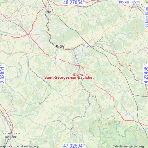
Saint-Georges-sur-Baulche GPS coordinates[2]
47° 48' 1.404" North, 3° 31' 53.184" East
| Map corner | latitude | longitude |
|---|---|---|
| Upper-left | 48.27054°, | 2.82831° |
| Center: | 47.80039°, | 3.53144° |
| Lower-right: | 47.32594°, | 4.23456° |
| Map W x H: | 105×105 km | = 65.2×65.2mi |
| max Lat: | 51.07786° ⇑44.3% North |
| Saint-Georges-sur-Baulche: | 47.80039° |
| min Lat: | ⇓55.7% South 41.3874° |
| min Long | Saint-Georges-s | max Long |
| -5.08615° | 3.53144° | 9.52242° |
| W 64.5%⇐ | ⇒35.5% E |
Elevation
Elevation of Saint-Georges-sur-Baulche is 159 m = 522 ft, and this is 34.7 m = 114 ft below average elevation for this country.
| Max E: |
2333 m = 7654 ft | 42.6% |
| Avg. | 193.7 m = 635 ft | |
| Saint-Georges-sur-Baulche | 159 m = 522 ft | |
Min E: |
-1 m = -3 ft | 57.4% |
See also: France elevation on elevation.city.
Geographical zone
Saint-Georges-sur-Baulche is located in North temperate zone (between Tropic of Cancer and the Arctic Circle). Distance of this North polar circle is 2086.3 km =1296.4 mi to North.| Distance of | km | miles | from Saint-Georges-sur-Baulche |
|---|---|---|---|
| North Pole | 4692.2 | 2915.6 | to North |
| Arctic Circle | 2086.3 | 1296.4 | to North |
| Tropic Cancer | 2709 | 1683.3 | to South |
| Equator | 5314.9 | 3302.5 | to South |


Nearby cities:
15 places around Saint-Georges-sur-Baulche: (largest is in red/bold)
• Appoigny
8.3 km =5.2 mi,  356°
356°
• Augy
7 km =4.3 mi,  122°
122°
• Auxerre
2.9 km =1.8 mi,  91°
91°
• Champs-sur-Yonne
9 km =5.6 mi,  145°
145°
• Charbuy
5.5 km =3.4 mi,  297°
297°
• Escamps
9 km =5.6 mi,  208°
208°
• Fleury-la-Vallée
9.6 km =6 mi,  320°
320°
• Gurgy
7.8 km =4.8 mi,  17°
17°
• Lindry
8.5 km =5.3 mi,  270°
270°
• Monéteau
6.6 km =4.1 mi,  34°
34°
• Pourrain
10.2 km =6.3 mi,  241°
241°
• Saint-Bris-le-Vineux
10.8 km =6.7 mi,  125°
125°
• Vallan
6.2 km =3.9 mi,  174°
174°
• Venoy
7.9 km =4.9 mi, 86°
• Villefargeau
3.1 km =1.9 mi,  223°
223°
Sources, notices
• [Note1] Compared only with cities in France existing in our database
• [Src1] Map data: © OpenStreetMap contributors (CC-BY-SA)
• [Src2] Other city data from geonames.org with taken over terms of usage.
• [Src3] Geographical zone / Annual Mean Temperature by Robert A. Rohde @ Wikipedia
