Ambrières-les-Vallées geodata
Ambrières-les-Vallées (Pays de la Loire) is a populated place; located in France in Europe/Paris (GMT+2) time zone. With population of 2,786 people, there are 3509 cities with bigger population in this country. Compared to other cities in France, 66.3% of cities are located further ↓South; 84.8% of cities are located further →East and 50.8% of cities have lower elevation than Ambrières-les-Vallées. Note1
Administrative division(s):
- Level 1: Pays de la Loire
- Level 2: Mayenne
- Level 3: Arrondissement de Mayenne
- Level 4: Ambrières-les-Vallées
Current local time in Ambrières-les-Vallées:
06:02 AM, WednesdayDifference from your time zone: hours


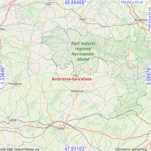
Ambrières-les-Vallées GPS coordinates[2]
48° 24' 0" North, 0° 37' 59.988" West
| Map corner | latitude | longitude |
|---|---|---|
| Upper-left | 48.86468°, | -1.33646° |
| Center: | 48.4°, | -0.63333° |
| Lower-right: | 47.93103°, | 0.06979° |
| Map W x H: | 103.8×103.8 km | = 64.5×64.5mi |
| max Lat: | 51.07786° ⇑33.7% North |
| Ambrières-les-Vallées: | 48.4° |
| min Lat: | ⇓66.3% South 41.3874° |
| min Long | Ambrières-les- | max Long |
| -5.08615° | -0.63333° | 9.52242° |
| W 15.2%⇐ | ⇒84.8% E |
Elevation
Elevation of Ambrières-les-Vallées is 135 m = 443 ft, and this is 58.7 m = 193 ft below average elevation for this country.
| Max E: |
2333 m = 7654 ft | 49.2% |
| Avg. | 193.7 m = 635 ft | |
| Ambrières-les-Vallées | 135 m = 443 ft | |
Min E: |
-1 m = -3 ft | 50.8% |
See also: France elevation on elevation.city.
Geographical zone
Ambrières-les-Vallées is located in North temperate zone (between Tropic of Cancer and the Arctic Circle). Distance of this North polar circle is 2019.6 km =1254.9 mi to North.| Distance of | km | miles | from Ambrières-les-Vallées |
|---|---|---|---|
| North Pole | 4625.5 | 2874.2 | to North |
| Arctic Circle | 2019.6 | 1254.9 | to North |
| Tropic Cancer | 2775.7 | 1724.7 | to South |
| Equator | 5381.6 | 3344 | to South |


Nearby cities:
15 places around Ambrières-les-Vallées: (largest is in red/bold)
• Aron
12.6 km =7.8 mi,  154°
154°
• Brecé
12.3 km =7.6 mi,  270°
270°
• Ceaucé
10.5 km =6.5 mi,  3°
3°
• Champéon
9.3 km =5.8 mi,  112°
112°
• Chantrigné
5 km =3.1 mi,  70°
70°
• Châtillon-sur-Colmont
10.7 km =6.6 mi,  229°
229°
• Lassay-les-Châteaux
10.9 km =6.8 mi, 66°
• Le Horps
12.7 km =7.9 mi,  91°
91°
• Le Pas
5.9 km =3.7 mi,  303°
303°
• Mayenne
10.9 km =6.8 mi,  172°
172°
• Oisseau
5.7 km =3.5 mi,  209°
209°
• Parigné-sur-Braye
9.5 km =5.9 mi,  188°
188°
• Saint-Fraimbault
10.5 km =6.5 mi,  332°
332°
• Saint-Fraimbault-de-Prières
6.9 km =4.3 mi,  144°
144°
• Saint-Georges-Buttavent
10.9 km =6.8 mi,  204°
204°
Sources, notices
• [Note1] Compared only with cities in France existing in our database
• [Src1] Map data: © OpenStreetMap contributors (CC-BY-SA)
• [Src2] Other city data from geonames.org with taken over terms of usage.
• [Src3] Geographical zone / Annual Mean Temperature by Robert A. Rohde @ Wikipedia
