Lassay-les-Châteaux geodata
Lassay-les-Châteaux (Pays de la Loire) is a populated place; located in France in Europe/Paris (GMT+2) time zone. With population of 2,650 people, there are 3675 cities with bigger population in this country. Compared to other cities in France, 67% of cities are located further ↓South; 83.3% of cities are located further →East and 65.6% of cities have lower elevation than Lassay-les-Châteaux. Note1
Administrative division(s):
- Level 1: Pays de la Loire
- Level 2: Mayenne
- Level 3: Arrondissement de Mayenne
- Level 4: Lassay-les-Châteaux


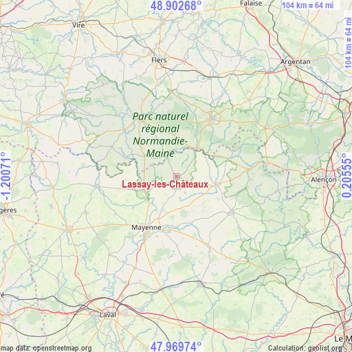
Lassay-les-Châteaux GPS coordinates[2]
48° 26' 18.06" North, 0° 29' 51.288" West
| Map corner | latitude | longitude |
|---|---|---|
| Upper-left | 48.90268°, | -1.20071° |
| Center: | 48.43835°, | -0.49758° |
| Lower-right: | 47.96974°, | 0.20555° |
| Map W x H: | 103.7×103.7 km | = 64.4×64.4mi |
| max Lat: | 51.07786° ⇑33% North |
| Lassay-les-Châteaux: | 48.43835° |
| min Lat: | ⇓67% South 41.3874° |
| min Long | Lassay-les-Châ | max Long |
| -5.08615° | -0.49758° | 9.52242° |
| W 16.7%⇐ | ⇒83.3% E |
Elevation
Elevation of Lassay-les-Châteaux is 197 m = 646 ft, and this is 3.3 m = 11 ft above average elevation for this country.
| Max E: |
2333 m = 7654 ft | 34.4% |
| Lassay-les-Châteaux | 197 m 646 ft | |
| Avg. | 193.7 m = 635 ft | |
Min E: |
-1 m = -3 ft | 65.6% |
See also: France elevation on elevation.city.
Geographical zone
Lassay-les-Châteaux is located in North temperate zone (between Tropic of Cancer and the Arctic Circle). Distance of this North polar circle is 2015.3 km =1252.2 mi to North.| Distance of | km | miles | from Lassay-les-Châteaux |
|---|---|---|---|
| North Pole | 4621.2 | 2871.5 | to North |
| Arctic Circle | 2015.3 | 1252.2 | to North |
| Tropic Cancer | 2779.9 | 1727.3 | to South |
| Equator | 5385.8 | 3346.6 | to South |


Nearby cities:
15 places around Lassay-les-Châteaux: (largest is in red/bold)
• Ambrières-les-Vallées
10.9 km =6.8 mi,  246°
246°
• Bagnoles-de-l'Orne
14.6 km =9.1 mi,  25°
25°
• Ceaucé
11.3 km =7 mi,  303°
303°
• Champéon
8 km =5 mi,  190°
190°
• Chantrigné
5.9 km =3.7 mi,  243°
243°
• Couterne
10.3 km =6.4 mi,  36°
36°
• Javron-les-Chapelles
12 km =7.5 mi,  100°
100°
• Juvigny-sous-Andaine
12.7 km =7.9 mi,  356°
356°
• Le Horps
5.3 km =3.3 mi,  148°
148°
• Le Pas
15 km =9.3 mi,  266°
266°
• Marcillé-la-Ville
14.7 km =9.1 mi,  179°
179°
• Oisseau
15.8 km =9.8 mi,  234°
234°
• Saint-Fraimbault
15.7 km =9.8 mi,  288°
288°
• Saint-Fraimbault-de-Prières
11.6 km =7.2 mi,  211°
211°
• Tessé-la-Madeleine
13.5 km =8.4 mi,  23°
23°
Sources, notices
• [Note1] Compared only with cities in France existing in our database
• [Src1] Map data: © OpenStreetMap contributors (CC-BY-SA)
• [Src2] Other city data from geonames.org with taken over terms of usage.
• [Src3] Geographical zone / Annual Mean Temperature by Robert A. Rohde @ Wikipedia
