Brecé geodata
Brecé (Pays de la Loire) is a populated place; located in France in Europe/Paris (GMT+2) time zone. With population of 816 people, there are 10420 cities with bigger population in this country. Compared to other cities in France, 66.3% of cities are located further ↓South; 86.4% of cities are located further →East and 58% of cities have lower elevation than Brecé. Note1
Administrative division(s):
- Level 1: Pays de la Loire
- Level 2: Mayenne
- Level 3: Arrondissement de Mayenne
- Level 4: Brecé


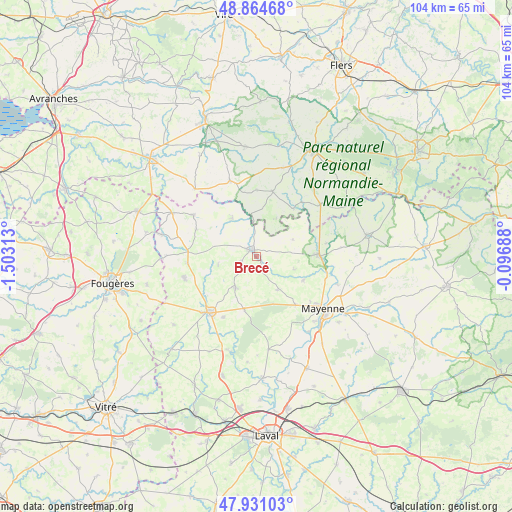
Brecé GPS coordinates[2]
48° 24' 0" North, 0° 48' 0" West
| Map corner | latitude | longitude |
|---|---|---|
| Upper-left | 48.86468°, | -1.50313° |
| Center: | 48.4°, | -0.8° |
| Lower-right: | 47.93103°, | -0.09688° |
| Map W x H: | 103.8×103.8 km | = 64.5×64.5mi |
| max Lat: | 51.07786° ⇑33.7% North |
| Brecé: | 48.4° |
| min Lat: | ⇓66.3% South 41.3874° |
| min Long | Brecé | max Long |
| -5.08615° | -0.8° | 9.52242° |
| W 13.6%⇐ | ⇒86.4% E |
Elevation
Elevation of Brecé is 161 m = 528 ft, and this is 32.7 m = 107 ft below average elevation for this country.
| Max E: |
2333 m = 7654 ft | 42% |
| Avg. | 193.7 m = 635 ft | |
| Brecé | 161 m = 528 ft | |
Min E: |
-1 m = -3 ft | 58% |
See also: France elevation on elevation.city.
Geographical zone
Brecé is located in North temperate zone (between Tropic of Cancer and the Arctic Circle). Distance of this North polar circle is 2019.6 km =1254.9 mi to North.| Distance of | km | miles | from Brecé |
|---|---|---|---|
| North Pole | 4625.5 | 2874.2 | to North |
| Arctic Circle | 2019.6 | 1254.9 | to North |
| Tropic Cancer | 2775.7 | 1724.7 | to South |
| Equator | 5381.6 | 3344 | to South |


Nearby cities:
15 places around Brecé: (largest is in red/bold)
• Ambrières-les-Vallées
12.3 km =7.6 mi,  90°
90°
• Châtillon-sur-Colmont
8.1 km =5 mi,  148°
148°
• Colombiers-du-Plessis
3.1 km =1.9 mi,  252°
252°
• Désertines
9.1 km =5.7 mi,  326°
326°
• Gorron
1.5 km =0.9 mi,  322°
322°
• Le Pas
8.1 km =5 mi,  65°
65°
• Mantilly
13.4 km =8.3 mi,  359°
359°
• Montaudin
14.1 km =8.8 mi,  263°
263°
• Montenay
14.3 km =8.9 mi,  209°
209°
• Oisseau
10.7 km =6.6 mi,  117°
117°
• Passais
13.2 km =8.2 mi,  10°
10°
• Saint-Denis-de-Gastines
7.8 km =4.8 mi, 213°
• Saint-Fraimbault
11.8 km =7.3 mi,  38°
38°
• Saint-Georges-Buttavent
12.7 km =7.9 mi,  141°
141°
• Vautorte
11.4 km =7.1 mi,  192°
192°
Sources, notices
• [Note1] Compared only with cities in France existing in our database
• [Src1] Map data: © OpenStreetMap contributors (CC-BY-SA)
• [Src2] Other city data from geonames.org with taken over terms of usage.
• [Src3] Geographical zone / Annual Mean Temperature by Robert A. Rohde @ Wikipedia
