Champéon geodata
Champéon (Pays de la Loire) is a populated place; located in France in Europe/Paris (GMT+2) time zone. With population of 535 people, there are 14511 cities with bigger population in this country. Compared to other cities in France, 65.8% of cities are located further ↓South; 83.6% of cities are located further →East and 65.2% of cities have lower elevation than Champéon. Note1
Administrative division(s):
- Level 1: Pays de la Loire
- Level 2: Mayenne
- Level 3: Arrondissement de Mayenne
- Level 4: Champéon


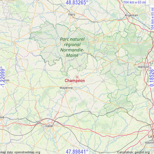
Champéon GPS coordinates[2]
48° 22' 3.612" North, 0° 31' 4.332" West
| Map corner | latitude | longitude |
|---|---|---|
| Upper-left | 48.83265°, | -1.22099° |
| Center: | 48.36767°, | -0.51787° |
| Lower-right: | 47.89841°, | 0.18526° |
| Map W x H: | 103.9×103.9 km | = 64.6×64.6mi |
| max Lat: | 51.07786° ⇑34.2% North |
| Champéon: | 48.36767° |
| min Lat: | ⇓65.8% South 41.3874° |
| min Long | Champéon | max Long |
| -5.08615° | -0.51787° | 9.52242° |
| W 16.4%⇐ | ⇒83.6% E |
Elevation
Elevation of Champéon is 195 m = 640 ft, and this is 1.3 m = 4 ft above average elevation for this country.
| Max E: |
2333 m = 7654 ft | 34.8% |
| Champéon | 195 m 640 ft | |
| Avg. | 193.7 m = 635 ft | |
Min E: |
-1 m = -3 ft | 65.2% |
See also: France elevation on elevation.city.
Geographical zone
Champéon is located in North temperate zone (between Tropic of Cancer and the Arctic Circle). Distance of this North polar circle is 2023.2 km =1257.2 mi to North.| Distance of | km | miles | from Champéon |
|---|---|---|---|
| North Pole | 4629.1 | 2876.4 | to North |
| Arctic Circle | 2023.2 | 1257.2 | to North |
| Tropic Cancer | 2772.1 | 1722.5 | to South |
| Equator | 5378 | 3341.7 | to South |


Nearby cities:
15 places around Champéon: (largest is in red/bold)
• Ambrières-les-Vallées
9.3 km =5.8 mi,  292°
292°
• Aron
8.3 km =5.2 mi,  201°
201°
• Chantrigné
6.5 km =4 mi,  324°
324°
• Grazay
9.1 km =5.7 mi,  162°
162°
• Jublains
12.6 km =7.8 mi,  172°
172°
• La Bazoge-Montpinçon
10.8 km =6.7 mi, 202°
• Lassay-les-Châteaux
8 km =5 mi,  10°
10°
• Le Horps
5.4 km =3.4 mi,  51°
51°
• Marcillé-la-Ville
7.1 km =4.4 mi, 165°
• Mayenne
10.1 km =6.3 mi,  224°
224°
• Moulay
13.3 km =8.3 mi, 217°
• Oisseau
11.4 km =7.1 mi,  263°
263°
• Parigné-sur-Braye
11.5 km =7.1 mi,  239°
239°
• Saint-Baudelle
13.1 km =8.1 mi, 222°
• Saint-Fraimbault-de-Prières
4.9 km =3 mi,  245°
245°
Sources, notices
• [Note1] Compared only with cities in France existing in our database
• [Src1] Map data: © OpenStreetMap contributors (CC-BY-SA)
• [Src2] Other city data from geonames.org with taken over terms of usage.
• [Src3] Geographical zone / Annual Mean Temperature by Robert A. Rohde @ Wikipedia
