Val Thorens geodata
Val Thorens (Auvergne-Rhône-Alpes) is a populated locality; located in France in Europe/Paris (GMT+2) time zone. With population of 2,500 people, there are 3893 cities with bigger population in this country. Compared to other cities in France, 76.4% of cities are located further ↑North; 92.3% of cities are located further ←West and 100% of cities have lower elevation than Val Thorens. Note1
Administrative division(s):
- Level 1: Auvergne-Rhône-Alpes
- Level 2: Savoie
- Level 3: Albertville
- Level 4: Les Belleville


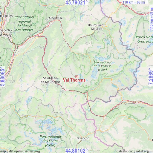
Val Thorens GPS coordinates[2]
45° 17' 51.972" North, 6° 35' 1.572" East
| Map corner | latitude | longitude |
|---|---|---|
| Upper-left | 45.79021°, | 5.88065° |
| Center: | 45.29777°, | 6.58377° |
| Lower-right: | 44.80102°, | 7.2869° |
| Map W x H: | 110×110 km | = 68.4×68.4mi |
| max Lat: | 51.07786° ⇑76.4% North |
| Val Thorens: | 45.29777° |
| min Lat: | ⇓23.6% South 41.3874° |
| min Long | Val Thorens | max Long |
| -5.08615° | 6.58377° | 9.52242° |
| W 92.3%⇐ | ⇒7.7% E |
Elevation
Elevation of Val Thorens is 2333 m = 7654 ft, and this is 2139.3 m = 7019 ft above average elevation for this country.
| Max E: |
2333 m = 7654 ft | 0% |
| Val Thorens | 2333 m 7654 ft | |
| Avg. | 193.7 m = 635 ft | |
Min E: |
-1 m = -3 ft | 100% |
See also: France elevation on elevation.city.
Geographical zone
Val Thorens is located in North temperate zone (between Tropic of Cancer and the Arctic Circle). Distance of this North polar circle is 2364.5 km =1469.2 mi to North.| Distance of | km | miles | from Val Thorens |
|---|---|---|---|
| North Pole | 4970.4 | 3088.5 | to North |
| Arctic Circle | 2364.5 | 1469.2 | to North |
| Tropic Cancer | 2430.7 | 1510.4 | to South |
| Equator | 5036.6 | 3129.6 | to South |


Nearby cities:
15 places around Val Thorens: (largest is in red/bold)
• Albanne
16.4 km =10.2 mi,  231°
231°
• Aussois
14.6 km =9.1 mi,  121°
121°
• Courchevel
13.7 km =8.5 mi,  17°
17°
• Fourneaux
13 km =8.1 mi,  156°
156°
• Les Allues
15.1 km =9.4 mi,  351°
351°
• Modane
12.7 km =7.9 mi,  148°
148°
• Méribel
13.1 km =8.1 mi, 353°
• Pralognan-la-Vanoise
14.2 km =8.8 mi,  47°
47°
• Saint-Bon-Tarentaise
15.7 km =9.8 mi, 15°
• Saint-Martin-de-Belleville
11.2 km =7 mi,  326°
326°
• Saint-Martin-de-la-Porte
12.6 km =7.8 mi,  238°
238°
• Saint-Michel-de-Maurienne
12.5 km =7.8 mi, 226°
• Valmeinier
14.8 km =9.2 mi,  212°
212°
• Villargondran
16.6 km =10.3 mi,  257°
257°
• Villarodin
14 km =8.7 mi,  135°
135°
Sources, notices
• [Note1] Compared only with cities in France existing in our database
• [Src1] Map data: © OpenStreetMap contributors (CC-BY-SA)
• [Src2] Other city data from geonames.org with taken over terms of usage.
• [Src3] Geographical zone / Annual Mean Temperature by Robert A. Rohde @ Wikipedia
