Whithorn geodata
Whithorn (Scotland) is a populated place; located in United Kingdom in Europe/London (GMT+0) time zone. With population of 790 people, there are 4040 cities with bigger population in this country. Compared to other cities in United Kingdom, 84.5% of cities are located further ↓South; 92.5% of cities are located further →East and 52.4% of cities have lower elevation than Whithorn. Note1


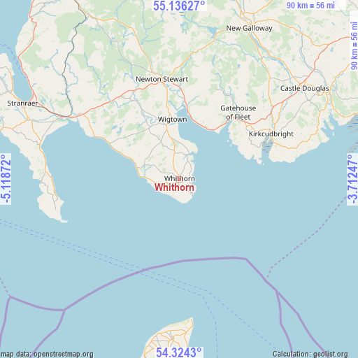
Whithorn GPS coordinates[2]
54° 43' 56.352" North, 4° 24' 56.124" West
| Map corner | latitude | longitude |
|---|---|---|
| Upper-left | 55.13627°, | -5.11872° |
| Center: | 54.73232°, | -4.41559° |
| Lower-right: | 54.3243°, | -3.71247° |
| Map W x H: | 90.3×90.3 km | = 56.1×56.1mi |
| max Lat: | 60.39635° ⇑15.5% North |
| Whithorn: | 54.73232° |
| min Lat: | ⇓84.5% South 34.60088° |
| min Long | Whithorn | max Long |
| -7.64133° | -4.41559° | 32.95536° |
| W 7.5%⇐ | ⇒92.5% E |
Elevation
Elevation of Whithorn is 64 m = 210 ft, and this is 8.9 m = 29 ft below average elevation for this country.
| Max E: |
515 m = 1690 ft | 47.6% |
| Avg. | 72.9 m = 239 ft | |
| Whithorn | 64 m = 210 ft | |
Min E: |
-30 m = -98 ft | 52.4% |
See also: United Kingdom elevation on elevation.city.
Geographical zone
Whithorn is located in North temperate zone (between Tropic of Cancer and the Arctic Circle). Distance of this North polar circle is 1315.5 km =817.4 mi to North.| Distance of | km | miles | from Whithorn |
|---|---|---|---|
| North Pole | 3921.4 | 2436.6 | to North |
| Arctic Circle | 1315.5 | 817.4 | to North |
| Tropic Cancer | 3479.7 | 2162.2 | to South |
| Equator | 6085.7 | 3781.5 | to South |


Nearby cities:
15 places around Whithorn: (largest is in red/bold)
• Cairnryan
46.9 km =29.1 mi,  304°
304°
• Castle Douglas
38.9 km =24.2 mi,  53°
53°
• Creetown
19 km =11.8 mi,  6°
6°
• Dalbeattie
44 km =27.3 mi,  59°
59°
• Flimby
57.7 km =35.9 mi,  94°
94°
• Gatehouse of Fleet
22.3 km =13.9 mi,  41°
41°
• Glenluce
30.1 km =18.7 mi, 302°
• Kirkcudbright
26.3 km =16.3 mi, 63°
• Lowca
56.9 km =35.4 mi,  107°
107°
• Newton Stewart
25.4 km =15.8 mi,  350°
350°
• Portpatrick
46.6 km =29 mi,  285°
285°
• Stranraer
43.5 km =27 mi, 295°
• Whitehaven
57.3 km =35.6 mi, 110°
• Wigtown
15.2 km =9.4 mi, 352°
• Workington
56.9 km =35.4 mi,  100°
100°
Sources, notices
• [Note1] Compared only with cities in United Kingdom existing in our database
• [Src1] Map data: © OpenStreetMap contributors (CC-BY-SA)
• [Src2] Other city data from geonames.org with taken over terms of usage.
• [Src3] Geographical zone / Annual Mean Temperature by Robert A. Rohde @ Wikipedia
