Stourport-on-Severn geodata
Stourport-on-Severn (England) is a seat of a fourth-order administrative division; located in United Kingdom in Europe/London (GMT+1) time zone. With population of 20,586 people, there are 573 cities with bigger population in this country. Compared to other cities in United Kingdom, 53% of cities are located further ↑North; 60.9% of cities are located further →East and 69.2% of cities have higher elevation than Stourport-on-Severn. Note1
Administrative division(s):
- Level 1: England
- Level 2: Worcestershire
- Level 3: Wyre Forest District
- Level 4: Stourport-on-Severn


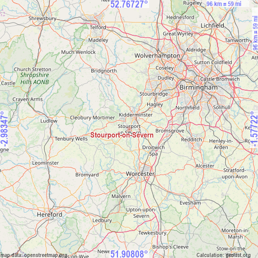
Stourport-on-Severn GPS coordinates[2]
52° 20' 23.136" North, 2° 16' 49.224" West
| Map corner | latitude | longitude |
|---|---|---|
| Upper-left | 52.76727°, | -2.98347° |
| Center: | 52.33976°, | -2.28034° |
| Lower-right: | 51.90808°, | -1.57722° |
| Map W x H: | 95.5×95.5 km | = 59.3×59.3mi |
| max Lat: | 60.39635° ⇑53% North |
| Stourport-on-Severn: | 52.33976° |
| min Lat: | ⇓47% South 34.60088° |
| min Long | Stourport-on-Se | max Long |
| -7.64133° | -2.28034° | 32.95536° |
| W 39.1%⇐ | ⇒60.9% E |
Elevation
Elevation of Stourport-on-Severn is 34 m = 112 ft, and this is 38.9 m = 128 ft below average elevation for this country.
| Max E: |
515 m = 1690 ft | 69.2% |
| Avg. | 72.9 m = 239 ft | |
| Stourport-on-Severn | 34 m = 112 ft | |
Min E: |
-30 m = -98 ft | 30.8% |
See also: United Kingdom elevation on elevation.city.
Geographical zone
Stourport-on-Severn is located in North temperate zone (between Tropic of Cancer and the Arctic Circle). Distance of this North polar circle is 1581.5 km =982.7 mi to North.| Distance of | km | miles | from Stourport-on-Severn |
|---|---|---|---|
| North Pole | 4187.4 | 2601.9 | to North |
| Arctic Circle | 1581.5 | 982.7 | to North |
| Tropic Cancer | 3213.7 | 1996.9 | to South |
| Equator | 5819.6 | 3616.1 | to South |


Nearby cities:
15 places around Stourport-on-Severn: (largest is in red/bold)
• Belbroughton
12.4 km =7.7 mi,  62°
62°
• Bewdley
4.8 km =3 mi,  327°
327°
• Callow Hill
6.7 km =4.2 mi,  288°
288°
• Droitwich
12 km =7.5 mi,  132°
132°
• Far Forest
8.9 km =5.5 mi, 292°
• Fernhill Heath
13.5 km =8.4 mi,  154°
154°
• Great Witley
7.7 km =4.8 mi,  227°
227°
• Hallow
13.1 km =8.1 mi,  172°
172°
• Hartlebury
3.3 km =2.1 mi,  102°
102°
• Kidderminster
5.8 km =3.6 mi,  20°
20°
• Kinvere
12.7 km =7.9 mi,  14°
14°
• Ombersley
8.4 km =5.2 mi,  155°
155°
• Romsley
12.5 km =7.8 mi,  348°
348°
• Stone
6.2 km =3.9 mi, 61°
• Wychbold
12.5 km =7.8 mi,  116°
116°
Sources, notices
• [Note1] Compared only with cities in United Kingdom existing in our database
• [Src1] Map data: © OpenStreetMap contributors (CC-BY-SA)
• [Src2] Other city data from geonames.org with taken over terms of usage.
• [Src3] Geographical zone / Annual Mean Temperature by Robert A. Rohde @ Wikipedia
