Far Forest geodata
Far Forest (England) is a populated place; located in United Kingdom in Europe/London (GMT+0) time zone. With population of 594 people, there are 4596 cities with bigger population in this country. Compared to other cities in United Kingdom, 52.3% of cities are located further ↑North; 63.1% of cities are located further →East and 88.5% of cities have lower elevation than Far Forest. Note1
Administrative division(s):
- Level 1: England
- Level 2: Worcestershire
- Level 3: Wyre Forest District
- Level 4: Rock


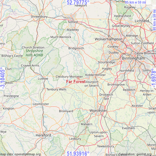
Far Forest GPS coordinates[2]
52° 22' 13.944" North, 2° 24' 3.348" West
| Map corner | latitude | longitude |
|---|---|---|
| Upper-left | 52.79775°, | -3.10405° |
| Center: | 52.37054°, | -2.40093° |
| Lower-right: | 51.93916°, | -1.6978° |
| Map W x H: | 95.5×95.5 km | = 59.3×59.3mi |
| max Lat: | 60.39635° ⇑52.3% North |
| Far Forest: | 52.37054° |
| min Lat: | ⇓47.7% South 34.60088° |
| min Long | Far Forest | max Long |
| -7.64133° | -2.40093° | 32.95536° |
| W 36.9%⇐ | ⇒63.1% E |
Elevation
Elevation of Far Forest is 145 m = 476 ft, and this is 72.1 m = 237 ft above average elevation for this country.
| Max E: |
515 m = 1690 ft | 11.5% |
| Far Forest | 145 m 476 ft | |
| Avg. | 72.9 m = 239 ft | |
Min E: |
-30 m = -98 ft | 88.5% |
See also: United Kingdom elevation on elevation.city.
Geographical zone
Far Forest is located in North temperate zone (between Tropic of Cancer and the Arctic Circle). Distance of this North polar circle is 1578.1 km =980.6 mi to North.| Distance of | km | miles | from Far Forest |
|---|---|---|---|
| North Pole | 4184 | 2599.8 | to North |
| Arctic Circle | 1578.1 | 980.6 | to North |
| Tropic Cancer | 3217.1 | 1999 | to South |
| Equator | 5823.1 | 3618.3 | to South |


Nearby cities:
15 places around Far Forest: (largest is in red/bold)
• Alveley
10.1 km =6.3 mi,  18°
18°
• Bewdley
5.6 km =3.5 mi,  84°
84°
• Callow Hill
2.3 km =1.4 mi,  124°
124°
• Cleobury Mortimer
5.6 km =3.5 mi,  279°
279°
• Clifton upon Teme
13.2 km =8.2 mi,  186°
186°
• Great Witley
8.9 km =5.5 mi,  164°
164°
• Hampton
10.8 km =6.7 mi,  6°
6°
• Hartlebury
12.1 km =7.5 mi,  109°
109°
• Highley
8.8 km =5.5 mi, 8°
• Kidderminster
10.4 km =6.5 mi, 79°
• Kinvere
14.4 km =8.9 mi,  52°
52°
• Romsley
10.5 km =6.5 mi,  32°
32°
• Stone
13.6 km =8.5 mi,  91°
91°
• Stourport-on-Severn
8.9 km =5.5 mi, 112°
• Tenbury Wells
14.8 km =9.2 mi,  243°
243°
Sources, notices
• [Note1] Compared only with cities in United Kingdom existing in our database
• [Src1] Map data: © OpenStreetMap contributors (CC-BY-SA)
• [Src2] Other city data from geonames.org with taken over terms of usage.
• [Src3] Geographical zone / Annual Mean Temperature by Robert A. Rohde @ Wikipedia
