Sandwick geodata
Sandwick (Scotland) is a populated place; located in United Kingdom in Europe/London (GMT+1) time zone. With population of 660 people, there are 4375 cities with bigger population in this country. Compared to other cities in United Kingdom, 99.7% of cities are located further ↓South; 99% of cities are located further →East and 92.6% of cities have higher elevation than Sandwick. Note1


Sandwick GPS coordinates[2]
58° 12' 13.608" North, 6° 21' 24.156" West
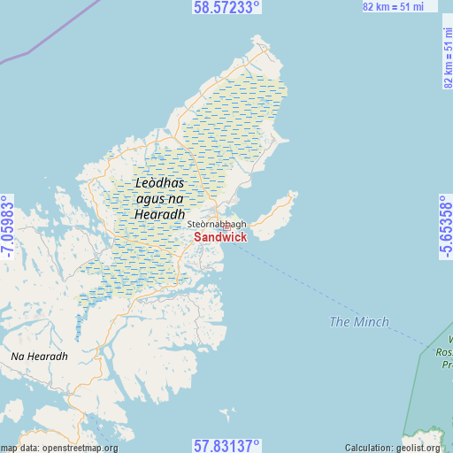
| Map corner | latitude | longitude |
|---|---|---|
| Upper-left | 58.57233°, | -7.05983° |
| Center: | 58.20378°, | -6.35671° |
| Lower-right: | 57.83137°, | -5.65358° |
| Map W x H: | 82.4×82.4 km | = 51.2×51.2mi |
| max Lat: | 60.39635° ⇑0.3% North |
| Sandwick: | 58.20378° |
| min Lat: | ⇓99.7% South 34.60088° |
| min Long | Sandwick | max Long |
| -7.64133° | -6.35671° | 32.95536° |
| W 1%⇐ | ⇒99% E |
Elevation
Elevation of Sandwick is 10 m = 33 ft, and this is 62.9 m = 206 ft below average elevation for this country.
| Max E: |
515 m = 1690 ft | 92.6% |
| Avg. | 72.9 m = 239 ft | |
| Sandwick | 10 m = 33 ft | |
Min E: |
-30 m = -98 ft | 7.4% |
See also: United Kingdom elevation on elevation.city.
Geographical zone
Sandwick is located in North temperate zone (between Tropic of Cancer and the Arctic Circle). Distance of this North polar circle is 929.5 km =577.6 mi to North.| Distance of | km | miles | from Sandwick |
|---|---|---|---|
| North Pole | 3535.4 | 2196.8 | to North |
| Arctic Circle | 929.5 | 577.6 | to North |
| Tropic Cancer | 3865.7 | 2402 | to South |
| Equator | 6471.7 | 4021.3 | to South |


Nearby cities:
15 places around Sandwick: (largest is in red/bold)
• Benbecula
102.4 km =63.6 mi,  214°
214°
• Broadford
110.2 km =68.5 mi,  166°
166°
• Conon Bridge
133.8 km =83.1 mi,  121°
121°
• Dingwall
132.6 km =82.4 mi, 120°
• Evanton
133.3 km =82.8 mi, 116°
• Isle of Lewis
2.5 km =1.6 mi,  312°
312°
• Isle of North Uist
88.3 km =54.9 mi,  221°
221°
• Isle of South Uist
121.3 km =75.4 mi, 208°
• Kyle of Lochalsh
109.2 km =67.9 mi,  159°
159°
• Maryburgh
133.1 km =82.7 mi, 121°
• Muir of Ord
135.6 km =84.3 mi, 124°
• Portree
88.5 km =55 mi, 173°
• Stornoway
1.8 km =1.1 mi,  289°
289°
• Strathpeffer
127.4 km =79.2 mi, 122°
• Ullapool
78.1 km =48.5 mi, 115°
Sources, notices
• [Note1] Compared only with cities in United Kingdom existing in our database
• [Src1] Map data: © OpenStreetMap contributors (CC-BY-SA)
• [Src2] Other city data from geonames.org with taken over terms of usage.
• [Src3] Geographical zone / Annual Mean Temperature by Robert A. Rohde @ Wikipedia
