Northam geodata
Northam (England) is a populated place; located in United Kingdom in Europe/London (GMT+1) time zone. With population of 7,668 people, there are 1266 cities with bigger population in this country. Compared to other cities in United Kingdom, 90.6% of cities are located further ↑North; 90.7% of cities are located further →East and 51.1% of cities have lower elevation than Northam. Note1
Administrative division(s):
- Level 1: England
- Level 2: Devon
- Level 3: Torridge District
- Level 4: Northam


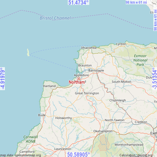
Northam GPS coordinates[2]
51° 1' 59.988" North, 4° 13' 0.012" West
| Map corner | latitude | longitude |
|---|---|---|
| Upper-left | 51.4734°, | -4.91979° |
| Center: | 51.03333°, | -4.21667° |
| Lower-right: | 50.58905°, | -3.51354° |
| Map W x H: | 98.3×98.3 km | = 61.1×61.1mi |
| max Lat: | 60.39635° ⇑90.6% North |
| Northam: | 51.03333° |
| min Lat: | ⇓9.4% South 34.60088° |
| min Long | Northam | max Long |
| -7.64133° | -4.21667° | 32.95536° |
| W 9.3%⇐ | ⇒90.7% E |
Elevation
Elevation of Northam is 62 m = 203 ft, and this is 10.9 m = 36 ft below average elevation for this country.
| Max E: |
515 m = 1690 ft | 48.9% |
| Avg. | 72.9 m = 239 ft | |
| Northam | 62 m = 203 ft | |
Min E: |
-30 m = -98 ft | 51.1% |
See also: United Kingdom elevation on elevation.city.
Geographical zone
Northam is located in North temperate zone (between Tropic of Cancer and the Arctic Circle). Distance of this North polar circle is 1726.8 km =1073 mi to North.| Distance of | km | miles | from Northam |
|---|---|---|---|
| North Pole | 4332.7 | 2692.2 | to North |
| Arctic Circle | 1726.8 | 1073 | to North |
| Tropic Cancer | 3068.5 | 1906.7 | to South |
| Equator | 5674.4 | 3525.9 | to South |


Nearby cities:
15 places around Northam: (largest is in red/bold)
• Appledore
2.2 km =1.4 mi,  32°
32°
• Barnstaple
12.2 km =7.6 mi,  64°
64°
• Bideford
1.9 km =1.2 mi,  162°
162°
• Bradworthy
18.7 km =11.6 mi,  218°
218°
• Braunton
9.2 km =5.7 mi,  24°
24°
• Croyde
10.8 km =6.7 mi,  357°
357°
• Fremington
6.9 km =4.3 mi,  54°
54°
• Great Torrington
10.3 km =6.4 mi,  150°
150°
• High Bickington
17.2 km =10.7 mi,  115°
115°
• Instow
3.5 km =2.2 mi, 49°
• Merton
18.6 km =11.6 mi, 153°
• Shebbear
19 km =11.8 mi,  179°
179°
• Swimbridge
17.3 km =10.7 mi,  82°
82°
• Woolacombe
15.5 km =9.6 mi,  2°
2°
• Woolfardisworthy
13.6 km =8.5 mi,  235°
235°
Sources, notices
• [Note1] Compared only with cities in United Kingdom existing in our database
• [Src1] Map data: © OpenStreetMap contributors (CC-BY-SA)
• [Src2] Other city data from geonames.org with taken over terms of usage.
• [Src3] Geographical zone / Annual Mean Temperature by Robert A. Rohde @ Wikipedia
