Kirkby Stephen geodata
Kirkby Stephen (England) is a populated place; located in United Kingdom in Europe/London (GMT+1) time zone. With population of 1,522 people, there are 3026 cities with bigger population in this country. Compared to other cities in United Kingdom, 81.7% of cities are located further ↓South; 62.3% of cities are located further →East and 94.2% of cities have lower elevation than Kirkby Stephen. Note1
Administrative division(s):
- Level 1: England
- Level 2: Cumbria
- Level 3: Eden District
- Level 4: Kirkby Stephen


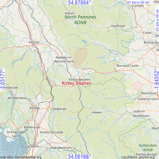
Kirkby Stephen GPS coordinates[2]
54° 28' 20.244" North, 2° 20' 55.14" West
| Map corner | latitude | longitude |
|---|---|---|
| Upper-left | 54.87884°, | -3.05177° |
| Center: | 54.47229°, | -2.34865° |
| Lower-right: | 54.06166°, | -1.64552° |
| Map W x H: | 90.9×90.9 km | = 56.5×56.5mi |
| max Lat: | 60.39635° ⇑18.3% North |
| Kirkby Stephen: | 54.47229° |
| min Lat: | ⇓81.7% South 34.60088° |
| min Long | Kirkby Stephen | max Long |
| -7.64133° | -2.34865° | 32.95536° |
| W 37.7%⇐ | ⇒62.3% E |
Elevation
Elevation of Kirkby Stephen is 176 m = 577 ft, and this is 103.1 m = 338 ft above average elevation for this country.
| Max E: |
515 m = 1690 ft | 5.8% |
| Kirkby Stephen | 176 m 577 ft | |
| Avg. | 72.9 m = 239 ft | |
Min E: |
-30 m = -98 ft | 94.2% |
See also: United Kingdom elevation on elevation.city.
Geographical zone
Kirkby Stephen is located in North temperate zone (between Tropic of Cancer and the Arctic Circle). Distance of this North polar circle is 1344.4 km =835.4 mi to North.| Distance of | km | miles | from Kirkby Stephen |
|---|---|---|---|
| North Pole | 3950.3 | 2454.6 | to North |
| Arctic Circle | 1344.4 | 835.4 | to North |
| Tropic Cancer | 3450.8 | 2144.2 | to South |
| Equator | 6056.8 | 3763.5 | to South |


Nearby cities:
15 places around Kirkby Stephen: (largest is in red/bold)
• Appleby-in-Westmorland
14.8 km =9.2 mi,  321°
321°
• Bowes
22 km =13.7 mi,  77°
77°
• Cotherstone
26.1 km =16.2 mi,  65°
65°
• Eggleston
27 km =16.8 mi,  55°
55°
• Hawes
21.2 km =13.2 mi,  152°
152°
• Holwick
22.5 km =14 mi,  36°
36°
• Kirkby Thore
21.9 km =13.6 mi, 321°
• Lartington
25.9 km =16.1 mi, 69°
• Mickleton
24.5 km =15.2 mi,  51°
51°
• Middleton in Teesdale
24.2 km =15 mi, 45°
• Newbiggin
23.3 km =14.5 mi, 36°
• Romaldkirk
25.7 km =16 mi, 58°
• Sedbergh
20.3 km =12.6 mi,  214°
214°
• Shap
22.1 km =13.7 mi,  287°
287°
• Temple Sowerby
24.3 km =15.1 mi, 317°
Sources, notices
• [Note1] Compared only with cities in United Kingdom existing in our database
• [Src1] Map data: © OpenStreetMap contributors (CC-BY-SA)
• [Src2] Other city data from geonames.org with taken over terms of usage.
• [Src3] Geographical zone / Annual Mean Temperature by Robert A. Rohde @ Wikipedia
