Hartland geodata
Hartland (England) is a populated place; located in United Kingdom in Europe/London (GMT+1) time zone. With population of 910 people, there are 3792 cities with bigger population in this country. Compared to other cities in United Kingdom, 91.4% of cities are located further ↑North; 92.9% of cities are located further →East and 78.1% of cities have lower elevation than Hartland. Note1
Administrative division(s):
- Level 1: England
- Level 2: Devon
- Level 3: Torridge District
- Level 4: Hartland


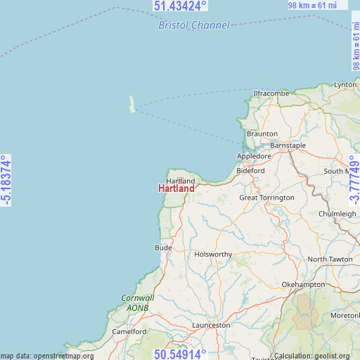
Hartland GPS coordinates[2]
50° 59' 37.68" North, 4° 28' 50.232" West
| Map corner | latitude | longitude |
|---|---|---|
| Upper-left | 51.43424°, | -5.18374° |
| Center: | 50.9938°, | -4.48062° |
| Lower-right: | 50.54914°, | -3.77749° |
| Map W x H: | 98.4×98.4 km | = 61.1×61.1mi |
| max Lat: | 60.39635° ⇑91.4% North |
| Hartland: | 50.9938° |
| min Lat: | ⇓8.6% South 34.60088° |
| min Long | Hartland | max Long |
| -7.64133° | -4.48062° | 32.95536° |
| W 7.1%⇐ | ⇒92.9% E |
Elevation
Elevation of Hartland is 113 m = 371 ft, and this is 40.1 m = 132 ft above average elevation for this country.
| Max E: |
515 m = 1690 ft | 21.9% |
| Hartland | 113 m 371 ft | |
| Avg. | 72.9 m = 239 ft | |
Min E: |
-30 m = -98 ft | 78.1% |
See also: United Kingdom elevation on elevation.city.
Geographical zone
Hartland is located in North temperate zone (between Tropic of Cancer and the Arctic Circle). Distance of this North polar circle is 1731.2 km =1075.7 mi to North.| Distance of | km | miles | from Hartland |
|---|---|---|---|
| North Pole | 4337.1 | 2694.9 | to North |
| Arctic Circle | 1731.2 | 1075.7 | to North |
| Tropic Cancer | 3064.1 | 1903.9 | to South |
| Equator | 5670 | 3523.2 | to South |


Nearby cities:
15 places around Hartland: (largest is in red/bold)
• Appledore
20.6 km =12.8 mi,  72°
72°
• Bideford
19.2 km =11.9 mi,  82°
82°
• Bradworthy
12.2 km =7.6 mi,  146°
146°
• Bude
19.3 km =12 mi,  192°
192°
• Croyde
23.4 km =14.5 mi,  49°
49°
• Flexbury
18.2 km =11.3 mi, 194°
• Great Torrington
24 km =14.9 mi,  100°
100°
• Holsworthy
22.1 km =13.7 mi,  156°
156°
• Instow
22.1 km =13.7 mi, 72°
• Kilkhampton
13.1 km =8.1 mi,  181°
181°
• Marhamchurch
21.2 km =13.2 mi, 187°
• Northam
19 km =11.8 mi, 76°
• Poughill
17.1 km =10.6 mi, 191°
• Shebbear
23.7 km =14.7 mi,  128°
128°
• Woolfardisworthy
7.9 km =4.9 mi,  114°
114°
Sources, notices
• [Note1] Compared only with cities in United Kingdom existing in our database
• [Src1] Map data: © OpenStreetMap contributors (CC-BY-SA)
• [Src2] Other city data from geonames.org with taken over terms of usage.
• [Src3] Geographical zone / Annual Mean Temperature by Robert A. Rohde @ Wikipedia
