Ford geodata
Ford (England) is a seat of a third-order administrative division; located in United Kingdom in Europe/London (GMT+0) time zone. In our database, there are 4977 cities with bigger population. Compared to other cities in United Kingdom, 89.6% of cities are located further ↓South; 56.4% of cities are located further →East and 66% of cities have lower elevation than Ford. Note1


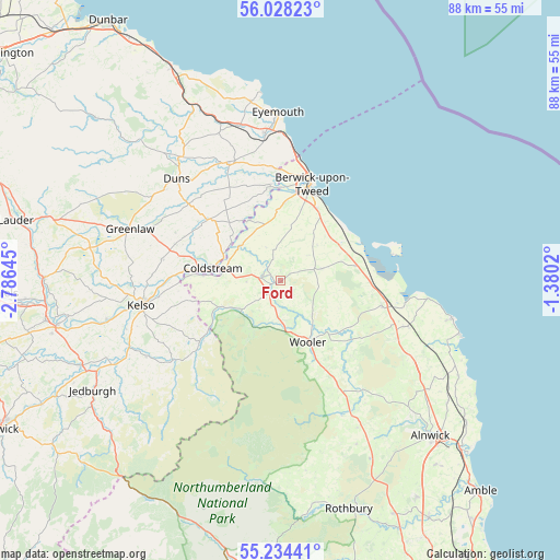
Ford GPS coordinates[2]
55° 37' 59.988" North, 2° 4' 59.988" West
| Map corner | latitude | longitude |
|---|---|---|
| Upper-left | 56.02823°, | -2.78645° |
| Center: | 55.63333°, | -2.08333° |
| Lower-right: | 55.23441°, | -1.3802° |
| Map W x H: | 88.3×88.3 km | = 54.9×54.9mi |
| max Lat: | 60.39635° ⇑10.4% North |
| Ford: | 55.63333° |
| min Lat: | ⇓89.6% South 34.60088° |
| min Long | Ford | max Long |
| -7.64133° | -2.08333° | 32.95536° |
| W 43.6%⇐ | ⇒56.4% E |
Elevation
Elevation of Ford is 88 m = 289 ft, and this is 15.1 m = 50 ft above average elevation for this country.
| Max E: |
515 m = 1690 ft | 34% |
| Ford | 88 m 289 ft | |
| Avg. | 72.9 m = 239 ft | |
Min E: |
-30 m = -98 ft | 66% |
See also: United Kingdom elevation on elevation.city.
Geographical zone
Ford is located in North temperate zone (between Tropic of Cancer and the Arctic Circle). Distance of this North polar circle is 1215.3 km =755.2 mi to North.| Distance of | km | miles | from Ford |
|---|---|---|---|
| North Pole | 3821.2 | 2374.4 | to North |
| Arctic Circle | 1215.3 | 755.2 | to North |
| Tropic Cancer | 3579.9 | 2224.4 | to South |
| Equator | 6185.8 | 3843.7 | to South |


Nearby cities:
15 places around Ford: (largest is in red/bold)
• Allanton
18.7 km =11.6 mi,  333°
333°
• Ancroft
9.1 km =5.7 mi,  35°
35°
• Belford
16.1 km =10 mi,  103°
103°
• Berwick-Upon-Tweed
15.3 km =9.5 mi,  16°
16°
• Chirnside
20.4 km =12.7 mi,  337°
337°
• Coldstream
10.8 km =6.7 mi,  280°
280°
• Doddington
7.3 km =4.5 mi,  136°
136°
• Duns
22.9 km =14.2 mi,  314°
314°
• Kelso
22.4 km =13.9 mi,  259°
259°
• Kirknewton
9.8 km =6.1 mi,  198°
198°
• Lowick
6.9 km =4.3 mi,  73°
73°
• Maxwellheugh
22.2 km =13.8 mi, 258°
• Norham
10.7 km =6.6 mi, 332°
• Town Yetholm
16.1 km =10 mi,  232°
232°
• Wooler
10.5 km =6.5 mi,  154°
154°
Sources, notices
• [Note1] Compared only with cities in United Kingdom existing in our database
• [Src1] Map data: © OpenStreetMap contributors (CC-BY-SA)
• [Src2] Other city data from geonames.org with taken over terms of usage.
• [Src3] Geographical zone / Annual Mean Temperature by Robert A. Rohde @ Wikipedia
