Delabole geodata
Delabole (England) is a populated place; located in United Kingdom in Europe/London (GMT+1) time zone. With population of 1,647 people, there are 2909 cities with bigger population in this country. Compared to other cities in United Kingdom, 97.3% of cities are located further ↑North; 94.9% of cities are located further →East and 97.9% of cities have lower elevation than Delabole. Note1


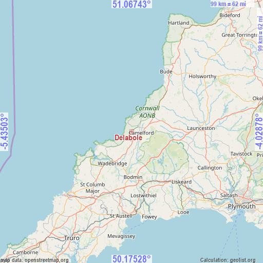
Delabole GPS coordinates[2]
50° 37' 24.492" North, 4° 43' 54.84" West
| Map corner | latitude | longitude |
|---|---|---|
| Upper-left | 51.06743°, | -5.43503° |
| Center: | 50.62347°, | -4.7319° |
| Lower-right: | 50.17528°, | -4.02878° |
| Map W x H: | 99.2×99.2 km | = 61.6×61.6mi |
| max Lat: | 60.39635° ⇑97.3% North |
| Delabole: | 50.62347° |
| min Lat: | ⇓2.7% South 34.60088° |
| min Long | Delabole | max Long |
| -7.64133° | -4.7319° | 32.95536° |
| W 5.1%⇐ | ⇒94.9% E |
Elevation
Elevation of Delabole is 220 m = 722 ft, and this is 147.1 m = 483 ft above average elevation for this country.
| Max E: |
515 m = 1690 ft | 2.1% |
| Delabole | 220 m 722 ft | |
| Avg. | 72.9 m = 239 ft | |
Min E: |
-30 m = -98 ft | 97.9% |
See also: United Kingdom elevation on elevation.city.
Geographical zone
Delabole is located in North temperate zone (between Tropic of Cancer and the Arctic Circle). Distance of this North polar circle is 1772.4 km =1101.3 mi to North.| Distance of | km | miles | from Delabole |
|---|---|---|---|
| North Pole | 4378.3 | 2720.5 | to North |
| Arctic Circle | 1772.4 | 1101.3 | to North |
| Tropic Cancer | 3022.9 | 1878.3 | to South |
| Equator | 5628.8 | 3497.6 | to South |


Nearby cities:
15 places around Delabole: (largest is in red/bold)
• Bodmin
16.9 km =10.5 mi,  178°
178°
• Boscastle
7.3 km =4.5 mi,  22°
22°
• Camelford
3.7 km =2.3 mi,  92°
92°
• Dobwalls
23.9 km =14.9 mi,  140°
140°
• Helland
13.8 km =8.6 mi, 175°
• Jacobstow
17.7 km =11 mi,  46°
46°
• Lanivet
20.1 km =12.5 mi,  186°
186°
• North Hill
22.6 km =14 mi,  111°
111°
• Padstow
17.2 km =10.7 mi,  236°
236°
• Polzeath
14.4 km =8.9 mi,  245°
245°
• Poundstock
20.4 km =12.7 mi,  38°
38°
• Rock
14.7 km =9.1 mi, 236°
• Tintagel
4.6 km =2.9 mi,  343°
343°
• Trewen
18.7 km =11.6 mi, 92°
• Wadebridge
13.9 km =8.6 mi,  212°
212°
Sources, notices
• [Note1] Compared only with cities in United Kingdom existing in our database
• [Src1] Map data: © OpenStreetMap contributors (CC-BY-SA)
• [Src2] Other city data from geonames.org with taken over terms of usage.
• [Src3] Geographical zone / Annual Mean Temperature by Robert A. Rohde @ Wikipedia
