Tintagel geodata
Tintagel (England) is a populated place; located in United Kingdom in Europe/London (GMT+1) time zone. With population of 1,028 people, there are 3589 cities with bigger population in this country. Compared to other cities in United Kingdom, 96.9% of cities are located further ↑North; 95% of cities are located further →East and 67.1% of cities have lower elevation than Tintagel. Note1


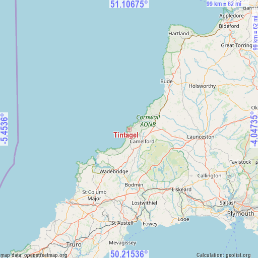
Tintagel GPS coordinates[2]
50° 39' 47.412" North, 4° 45' 1.692" West
| Map corner | latitude | longitude |
|---|---|---|
| Upper-left | 51.10675°, | -5.4536° |
| Center: | 50.66317°, | -4.75047° |
| Lower-right: | 50.21536°, | -4.04735° |
| Map W x H: | 99.1×99.1 km | = 61.6×61.6mi |
| max Lat: | 60.39635° ⇑96.9% North |
| Tintagel: | 50.66317° |
| min Lat: | ⇓3.1% South 34.60088° |
| min Long | Tintagel | max Long |
| -7.64133° | -4.75047° | 32.95536° |
| W 5%⇐ | ⇒95% E |
Elevation
Elevation of Tintagel is 90 m = 295 ft, and this is 17.1 m = 56 ft above average elevation for this country.
| Max E: |
515 m = 1690 ft | 32.9% |
| Tintagel | 90 m 295 ft | |
| Avg. | 72.9 m = 239 ft | |
Min E: |
-30 m = -98 ft | 67.1% |
See also: United Kingdom elevation on elevation.city.
Geographical zone
Tintagel is located in North temperate zone (between Tropic of Cancer and the Arctic Circle). Distance of this North polar circle is 1768 km =1098.6 mi to North.| Distance of | km | miles | from Tintagel |
|---|---|---|---|
| North Pole | 4373.8 | 2717.8 | to North |
| Arctic Circle | 1768 | 1098.6 | to North |
| Tropic Cancer | 3027.3 | 1881.1 | to South |
| Equator | 5633.2 | 3500.3 | to South |


Nearby cities:
15 places around Tintagel: (largest is in red/bold)
• Bodmin
21.4 km =13.3 mi,  175°
175°
• Boscastle
4.7 km =2.9 mi,  60°
60°
• Bude
23.2 km =14.4 mi,  39°
39°
• Camelford
6.8 km =4.2 mi,  132°
132°
• Delabole
4.6 km =2.9 mi,  163°
163°
• Flexbury
24 km =14.9 mi, 37°
• Helland
18.3 km =11.4 mi,  172°
172°
• Jacobstow
16.1 km =10 mi, 61°
• Marhamchurch
22.5 km =14 mi,  45°
45°
• Padstow
19.1 km =11.9 mi,  223°
223°
• Polzeath
15.7 km =9.8 mi,  228°
228°
• Poundstock
18.2 km =11.3 mi, 50°
• Rock
16.7 km =10.4 mi, 220°
• Trewen
20.7 km =12.9 mi,  104°
104°
• Wadebridge
17.3 km =10.7 mi,  200°
200°
Sources, notices
• [Note1] Compared only with cities in United Kingdom existing in our database
• [Src1] Map data: © OpenStreetMap contributors (CC-BY-SA)
• [Src2] Other city data from geonames.org with taken over terms of usage.
• [Src3] Geographical zone / Annual Mean Temperature by Robert A. Rohde @ Wikipedia
