Culmore geodata
Culmore (Northern Ireland) is a populated place; located in United Kingdom in Europe/London (GMT+1) time zone. With population of 3,645 people, there are 1940 cities with bigger population in this country. Compared to other cities in United Kingdom, 87% of cities are located further ↓South; 99.7% of cities are located further →East and 98.4% of cities have higher elevation than Culmore. Note1


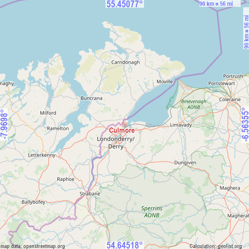
Culmore GPS coordinates[2]
55° 3' 0" North, 7° 16' 0.012" West
| Map corner | latitude | longitude |
|---|---|---|
| Upper-left | 55.45077°, | -7.9698° |
| Center: | 55.05°, | -7.26667° |
| Lower-right: | 54.64518°, | -6.56355° |
| Map W x H: | 89.6×89.6 km | = 55.7×55.7mi |
| max Lat: | 60.39635° ⇑13% North |
| Culmore: | 55.05° |
| min Lat: | ⇓87% South 34.60088° |
| min Long | Culmore | max Long |
| -7.64133° | -7.26667° | 32.95536° |
| W 0.3%⇐ | ⇒99.7% E |
Elevation
Elevation of Culmore is 5 m = 16 ft, and this is 67.9 m = 223 ft below average elevation for this country.
| Max E: |
515 m = 1690 ft | 98.4% |
| Avg. | 72.9 m = 239 ft | |
| Culmore | 5 m = 16 ft | |
Min E: |
-30 m = -98 ft | 1.6% |
See also: United Kingdom elevation on elevation.city.
Geographical zone
Culmore is located in North temperate zone (between Tropic of Cancer and the Arctic Circle). Distance of this North polar circle is 1280.2 km =795.5 mi to North.| Distance of | km | miles | from Culmore |
|---|---|---|---|
| North Pole | 3886.1 | 2414.7 | to North |
| Arctic Circle | 1280.2 | 795.5 | to North |
| Tropic Cancer | 3515.1 | 2184.2 | to South |
| Equator | 6121 | 3803.4 | to South |


Nearby cities:
15 places around Culmore: (largest is in red/bold)
• Ballykelly
15.8 km =9.8 mi,  92°
92°
• Castlerock
32.7 km =20.3 mi,  70°
70°
• Coleraine
39.3 km =24.4 mi,  76°
76°
• Derry
6.4 km =4 mi,  205°
205°
• Draperstown
42.3 km =26.3 mi,  131°
131°
• Dungiven
25.8 km =16 mi,  120°
120°
• Eglinton
6.5 km =4 mi, 124°
• Garvagh
39 km =24.2 mi,  100°
100°
• Limavady
20.1 km =12.5 mi, 89°
• Londonderry County Borough
6.5 km =4 mi,  204°
204°
• Newtownstewart
37.6 km =23.4 mi,  190°
190°
• Portrush
42.5 km =26.4 mi, 67°
• Portstewart
38.1 km =23.7 mi, 67°
• Sion Mills
32 km =19.9 mi, 204°
• Strabane
28.3 km =17.6 mi, 207°
Sources, notices
• [Note1] Compared only with cities in United Kingdom existing in our database
• [Src1] Map data: © OpenStreetMap contributors (CC-BY-SA)
• [Src2] Other city data from geonames.org with taken over terms of usage.
• [Src3] Geographical zone / Annual Mean Temperature by Robert A. Rohde @ Wikipedia
