Barrowby geodata
Barrowby (England) is a populated place; located in United Kingdom in Europe/London (GMT+0) time zone. With population of 1,952 people, there are 2662 cities with bigger population in this country. Compared to other cities in United Kingdom, 59.3% of cities are located further ↓South; 72.4% of cities are located further ←West and 75.2% of cities have lower elevation than Barrowby. Note1
Administrative division(s):
- Level 1: England
- Level 2: Lincolnshire
- Level 3: South Kesteven District
- Level 4: Barrowby


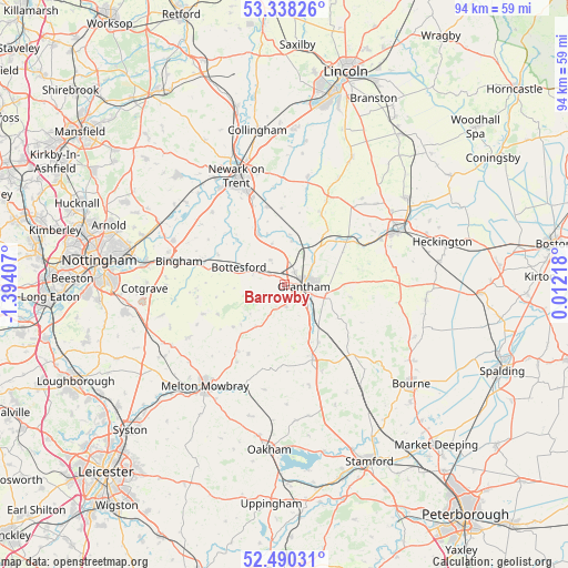
Barrowby GPS coordinates[2]
52° 54' 58.896" North, 0° 41' 27.384" West
| Map corner | latitude | longitude |
|---|---|---|
| Upper-left | 53.33826°, | -1.39407° |
| Center: | 52.91636°, | -0.69094° |
| Lower-right: | 52.49031°, | 0.01218° |
| Map W x H: | 94.3×94.3 km | = 58.6×58.6mi |
| max Lat: | 60.39635° ⇑40.7% North |
| Barrowby: | 52.91636° |
| min Lat: | ⇓59.3% South 34.60088° |
| min Long | Barrowby | max Long |
| -7.64133° | -0.69094° | 32.95536° |
| W 72.4%⇐ | ⇒27.6% E |
Elevation
Elevation of Barrowby is 107 m = 351 ft, and this is 34.1 m = 112 ft above average elevation for this country.
| Max E: |
515 m = 1690 ft | 24.8% |
| Barrowby | 107 m 351 ft | |
| Avg. | 72.9 m = 239 ft | |
Min E: |
-30 m = -98 ft | 75.2% |
See also: United Kingdom elevation on elevation.city.
Geographical zone
Barrowby is located in North temperate zone (between Tropic of Cancer and the Arctic Circle). Distance of this North polar circle is 1517.4 km =942.9 mi to North.| Distance of | km | miles | from Barrowby |
|---|---|---|---|
| North Pole | 4123.3 | 2562.1 | to North |
| Arctic Circle | 1517.4 | 942.9 | to North |
| Tropic Cancer | 3277.8 | 2036.7 | to South |
| Equator | 5883.7 | 3656 | to South |


Nearby cities:
15 places around Barrowby: (largest is in red/bold)
• Allington
4.7 km =2.9 mi,  330°
330°
• Ancaster
12.7 km =7.9 mi,  54°
54°
• Aslockton
14.4 km =8.9 mi,  286°
286°
• Bottesford
7.9 km =4.9 mi, 290°
• Caythorpe
12.7 km =7.9 mi,  28°
28°
• Claypole
13.1 km =8.1 mi,  347°
347°
• Colsterworth
13.1 km =8.1 mi,  158°
158°
• Croxton Kerrial
8.3 km =5.2 mi,  214°
214°
• Grantham
3.3 km =2.1 mi,  99°
99°
• Great Gonerby
2.6 km =1.6 mi,  37°
37°
• Harlaxton
3.6 km =2.2 mi,  176°
176°
• Long Bennington
9.6 km =6 mi, 332°
• Ropsley
11.3 km =7 mi, 100°
• Stathern
12.1 km =7.5 mi,  245°
245°
• Waltham on the Wolds
13.6 km =8.5 mi,  215°
215°
Sources, notices
• [Note1] Compared only with cities in United Kingdom existing in our database
• [Src1] Map data: © OpenStreetMap contributors (CC-BY-SA)
• [Src2] Other city data from geonames.org with taken over terms of usage.
• [Src3] Geographical zone / Annual Mean Temperature by Robert A. Rohde @ Wikipedia
