St. Buryan geodata
St. Buryan (England) is a seat of a third-order administrative division; located in United Kingdom in Europe/London (GMT+1) time zone. In our database, there are 4977 cities with bigger population. Compared to other cities in United Kingdom, 99.9% of cities are located further ↑North; 97.8% of cities are located further →East and 80.9% of cities have lower elevation than St. Buryan. Note1


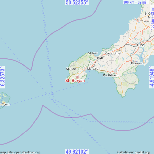
St. Buryan GPS coordinates[2]
50° 4' 27.876" North, 5° 37' 21.36" West
| Map corner | latitude | longitude |
|---|---|---|
| Upper-left | 50.52355°, | -6.32573° |
| Center: | 50.07441°, | -5.6226° |
| Lower-right: | 49.62102°, | -4.91948° |
| Map W x H: | 100.4×100.3 km | = 62.4×62.3mi |
| max Lat: | 60.39635° ⇑99.9% North |
| St. Buryan: | 50.07441° |
| min Lat: | ⇓0.1% South 34.60088° |
| min Long | St. Buryan | max Long |
| -7.64133° | -5.6226° | 32.95536° |
| W 2.2%⇐ | ⇒97.8% E |
Elevation
Elevation of St. Buryan is 120 m = 394 ft, and this is 47.1 m = 155 ft above average elevation for this country.
| Max E: |
515 m = 1690 ft | 19.1% |
| St. Buryan | 120 m 394 ft | |
| Avg. | 72.9 m = 239 ft | |
Min E: |
-30 m = -98 ft | 80.9% |
See also: United Kingdom elevation on elevation.city.
Geographical zone
St. Buryan is located in North temperate zone (between Tropic of Cancer and the Arctic Circle). Distance of this North polar circle is 1833.4 km =1139.2 mi to North.| Distance of | km | miles | from St. Buryan |
|---|---|---|---|
| North Pole | 4439.3 | 2758.5 | to North |
| Arctic Circle | 1833.4 | 1139.2 | to North |
| Tropic Cancer | 2961.8 | 1840.4 | to South |
| Equator | 5567.8 | 3459.7 | to South |


Nearby cities:
15 places around St. Buryan: (largest is in red/bold)
• Camborne
27.8 km =17.3 mi,  56°
56°
• Germoe
18 km =11.2 mi,  75°
75°
• Hayle
18.8 km =11.7 mi,  49°
49°
• Helston
25.3 km =15.7 mi, 82°
• Madron
7.7 km =4.8 mi,  32°
32°
• Marazion
12 km =7.5 mi, 61°
• Mousehole
6 km =3.7 mi, 80°
• Mullion
27.6 km =17.1 mi,  100°
100°
• Penzance
7.8 km =4.8 mi, 51°
• Porthleven
22 km =13.7 mi,  86°
86°
• Sennen
5.6 km =3.5 mi,  273°
273°
• St Ives
17.8 km =11.1 mi, 32°
• St Just
6.9 km =4.3 mi,  322°
322°
• Uny Lelant
17.7 km =11 mi, 47°
• Wendron
27.4 km =17 mi, 76°
Sources, notices
• [Note1] Compared only with cities in United Kingdom existing in our database
• [Src1] Map data: © OpenStreetMap contributors (CC-BY-SA)
• [Src2] Other city data from geonames.org with taken over terms of usage.
• [Src3] Geographical zone / Annual Mean Temperature by Robert A. Rohde @ Wikipedia
