Gorelovka geodata
Gorelovka (Samtskhe-Javakheti) is a populated place; located in Georgia in Asia/Tbilisi (GMT+4) time zone. With population of 700 people, there are 104 cities with bigger population in this country. Compared to other cities in Georgia, 100% of cities are located further ↑North; 63.2% of cities are located further ←West and 99.1% of cities have lower elevation than Gorelovka. Note1


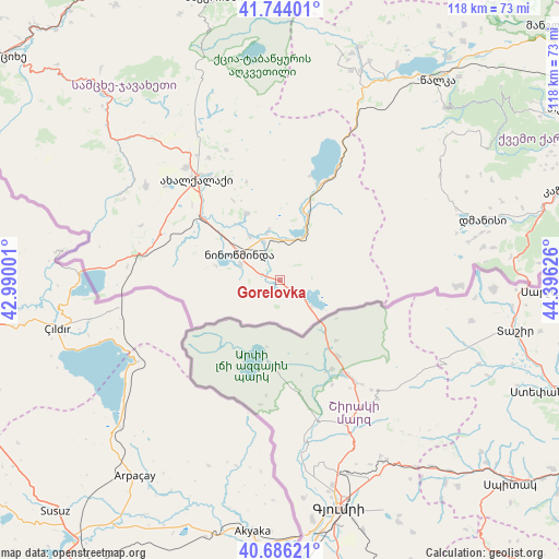
Gorelovka GPS coordinates[2]
41° 13' 2.1" North, 43° 41' 35.268" East
| Map corner | latitude | longitude |
|---|---|---|
| Upper-left | 41.74401°, | 42.99001° |
| Center: | 41.21725°, | 43.69313° |
| Lower-right: | 40.68621°, | 44.39626° |
| Map W x H: | 117.6×117.6 km | = 73.1×73.1mi |
| max Lat: | 43.38111° ⇑100% North |
| Gorelovka: | 41.21725° |
| min Lat: | ⇓0% South 41.21725° |
| min Long | Gorelovka | max Long |
| 40.07944° | 43.69313° | 46.27667° |
| W 63.2%⇐ | ⇒36.8% E |
Elevation
Elevation of Gorelovka is 2054 m = 6739 ft, and this is 1475.2 m = 4840 ft above average elevation for this country.
| Max E: |
2223 m = 7293 ft | 0.90000000000001% |
| Gorelovka | 2054 m 6739 ft | |
| Avg. | 578.8 m = 1899 ft | |
Min E: |
1 m = 3 ft | 99.1% |
See also: Georgia elevation on elevation.city.
Geographical zone
Gorelovka is located in North temperate zone (between Tropic of Cancer and the Arctic Circle). Distance of this Northern Tropic circle is 1977 km =1228.5 mi to South.| Distance of | km | miles | from Gorelovka |
|---|---|---|---|
| North Pole | 5424.1 | 3370.4 | to North |
| Arctic Circle | 2818.2 | 1751.1 | to North |
| Tropic Cancer | 1977 | 1228.5 | to South |
| Equator | 4582.9 | 2847.7 | to South |


Nearby cities:
15 places around Gorelovka: (largest is in red/bold)
• Akhaldaba
81 km =50.3 mi,  347°
347°
• Akhalk’alak’i
27.1 km =16.8 mi,  320°
320°
• Akhaltsikhe
75.5 km =46.9 mi,  308°
308°
• Aspindza
54.3 km =33.7 mi, 316°
• Bakuriani
60.7 km =37.7 mi, 347°
• Bakurianis Andeziti
60.3 km =37.5 mi,  342°
342°
• Bolnisi
75.1 km =46.7 mi,  70°
70°
• Borjomi
74.4 km =46.2 mi, 341°
• Dmanisi
64.4 km =40 mi,  57°
57°
• Khert’visi
44.7 km =27.8 mi, 310°
• Manglisi
78.5 km =48.8 mi,  47°
47°
• Ninotsminda
10 km =6.2 mi,  301°
301°
• Tsaghveri
67.5 km =41.9 mi, 344°
• Tsalka
53.4 km =33.2 mi,  38°
38°
• T’et’ri Tsqaro
73.7 km =45.8 mi, 60°
Sources, notices
• [Note1] Compared only with cities in Georgia existing in our database
• [Src1] Map data: © OpenStreetMap contributors (CC-BY-SA)
• [Src2] Other city data from geonames.org with taken over terms of usage.
• [Src3] Geographical zone / Annual Mean Temperature by Robert A. Rohde @ Wikipedia
