Akhaldaba geodata
Akhaldaba (Samtskhe-Javakheti) is a populated place; located in Georgia in Asia/Tbilisi (GMT+4) time zone. With population of 2,400 people, there are 81 cities with bigger population in this country. Compared to other cities in Georgia, 55.6% of cities are located further ↑North; 59% of cities are located further ←West and 65.8% of cities have lower elevation than Akhaldaba. Note1


Akhaldaba GPS coordinates[2]
41° 55' 46.02" North, 43° 29' 15.432" East
| Map corner | latitude | longitude |
|---|---|---|
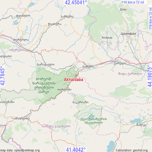
| Upper-left | 42.45041°, | 42.7845° |
| Center: | 41.92945°, | 43.48762° |
| Lower-right: | 41.4042°, | 44.19075° |
| Map W x H: | 116.3×116.3 km | = 72.3×72.3mi |
| max Lat: | 43.38111° ⇑55.6% North |
| Akhaldaba: | 41.92945° |
| min Lat: | ⇓44.4% South 41.21725° |
| min Long | Akhaldaba | max Long |
| 40.07944° | 43.48762° | 46.27667° |
| W 59%⇐ | ⇒41% E |
Elevation
Elevation of Akhaldaba is 742 m = 2434 ft, and this is 163.2 m = 535 ft above average elevation for this country.
| Max E: |
2223 m = 7293 ft | 34.2% |
| Akhaldaba | 742 m 2434 ft | |
| Avg. | 578.8 m = 1899 ft | |
Min E: |
1 m = 3 ft | 65.8% |
See also: Georgia elevation on elevation.city.
Geographical zone
Akhaldaba is located in North temperate zone (between Tropic of Cancer and the Arctic Circle). Distance of this Northern Tropic circle is 2056.2 km =1277.7 mi to South.| Distance of | km | miles | from Akhaldaba |
|---|---|---|---|
| North Pole | 5344.9 | 3321.2 | to North |
| Arctic Circle | 2739.1 | 1702 | to North |
| Tropic Cancer | 2056.2 | 1277.7 | to South |
| Equator | 4662.1 | 2896.9 | to South |


Nearby cities:
15 places around Akhaldaba: (largest is in red/bold)
• Agara
30.3 km =18.8 mi,  66°
66°
• Aspindza
44.2 km =27.5 mi,  206°
206°
• Bakuriani
20.3 km =12.6 mi,  169°
169°
• Bakurianis Andeziti
21.8 km =13.5 mi,  183°
183°
• Borjomi
10.5 km =6.5 mi,  215°
215°
• Chiat’ura
43.8 km =27.2 mi,  339°
339°
• Kats’khi
46.4 km =28.8 mi,  330°
330°
• Kharagauli
26.1 km =16.2 mi,  293°
293°
• Khashuri
11.7 km =7.3 mi,  52°
52°
• Khet’agurovi
45.6 km =28.3 mi, 47°
• Shorapani
37.6 km =23.4 mi,  298°
298°
• Surami
11.9 km =7.4 mi,  28°
28°
• Tsaghveri
14 km =8.7 mi, 181°
• Zestap’oni
41.2 km =25.6 mi, 299°
• Znaur
37.7 km =23.4 mi,  38°
38°
Sources, notices
• [Note1] Compared only with cities in Georgia existing in our database
• [Src1] Map data: © OpenStreetMap contributors (CC-BY-SA)
• [Src2] Other city data from geonames.org with taken over terms of usage.
• [Src3] Geographical zone / Annual Mean Temperature by Robert A. Rohde @ Wikipedia
