Ninotsminda geodata
Ninotsminda (Samtskhe-Javakheti) is a seat of a second-order administrative division; located in Georgia in Asia/Tbilisi (GMT+4) time zone. With population of 6,141 people, there are 49 cities with bigger population in this country. Compared to other cities in Georgia, 99.1% of cities are located further ↑North; 61.5% of cities are located further ←West and 98.3% of cities have lower elevation than Ninotsminda. Note1


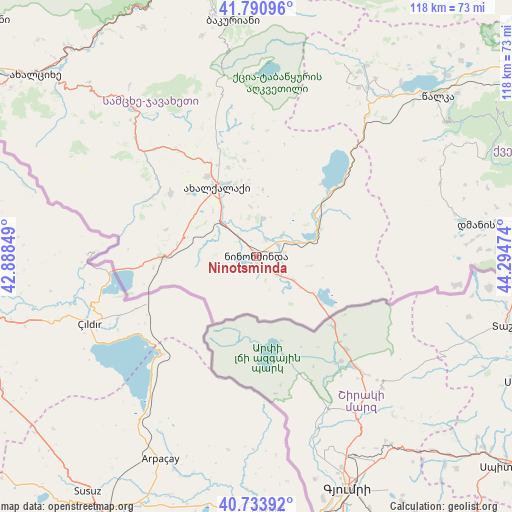
Ninotsminda GPS coordinates[2]
41° 15' 52.488" North, 43° 35' 29.796" East
| Map corner | latitude | longitude |
|---|---|---|
| Upper-left | 41.79096°, | 42.88849° |
| Center: | 41.26458°, | 43.59161° |
| Lower-right: | 40.73392°, | 44.29474° |
| Map W x H: | 117.5×117.5 km | = 73×73mi |
| max Lat: | 43.38111° ⇑99.1% North |
| Ninotsminda: | 41.26458° |
| min Lat: | ⇓0.9% South 41.21725° |
| min Long | Ninotsminda | max Long |
| 40.07944° | 43.59161° | 46.27667° |
| W 61.5%⇐ | ⇒38.5% E |
Elevation
Elevation of Ninotsminda is 1944 m = 6378 ft, and this is 1365.2 m = 4479 ft above average elevation for this country.
| Max E: |
2223 m = 7293 ft | 1.7% |
| Ninotsminda | 1944 m 6378 ft | |
| Avg. | 578.8 m = 1899 ft | |
Min E: |
1 m = 3 ft | 98.3% |
See also: Georgia elevation on elevation.city.
Geographical zone
Ninotsminda is located in North temperate zone (between Tropic of Cancer and the Arctic Circle). Distance of this Northern Tropic circle is 1982.3 km =1231.7 mi to South.| Distance of | km | miles | from Ninotsminda |
|---|---|---|---|
| North Pole | 5418.9 | 3367.1 | to North |
| Arctic Circle | 2813 | 1747.9 | to North |
| Tropic Cancer | 1982.3 | 1231.7 | to South |
| Equator | 4588.2 | 2851 | to South |


Nearby cities:
15 places around Ninotsminda: (largest is in red/bold)
• Abastumani
79.3 km =49.3 mi,  308°
308°
• Akhaldaba
74.4 km =46.2 mi,  353°
353°
• Akhalk’alak’i
17.9 km =11.1 mi,  330°
330°
• Akhaltsikhe
65.6 km =40.8 mi, 309°
• Aspindza
44.7 km =27.8 mi,  320°
320°
• Bakuriani
54.2 km =33.7 mi, 354°
• Bakurianis Andeziti
53.1 km =33 mi, 349°
• Borjomi
67.1 km =41.7 mi, 347°
• Dmanisi
69.4 km =43.1 mi,  65°
65°
• Gorelovka
10 km =6.2 mi,  121°
121°
• Khert’visi
34.8 km =21.6 mi, 312°
• Tsaghveri
60.6 km =37.7 mi, 351°
• Tsalka
55.4 km =34.4 mi,  48°
48°
• T’et’ri Tsqaro
78.9 km =49 mi, 66°
• Vale
71.5 km =44.4 mi,  303°
303°
Sources, notices
• [Note1] Compared only with cities in Georgia existing in our database
• [Src1] Map data: © OpenStreetMap contributors (CC-BY-SA)
• [Src2] Other city data from geonames.org with taken over terms of usage.
• [Src3] Geographical zone / Annual Mean Temperature by Robert A. Rohde @ Wikipedia
