Akhaltsikhe geodata
Akhaltsikhe (Samtskhe-Javakheti) is a seat of a first-order administrative division; located in Georgia in Asia/Tbilisi (GMT+4) time zone. With population of 17,298 people, there are 19 cities with bigger population in this country. Compared to other cities in Georgia, 82.9% of cities are located further ↑North; 55.6% of cities are located further →East and 77.8% of cities have lower elevation than Akhaltsikhe. Note1


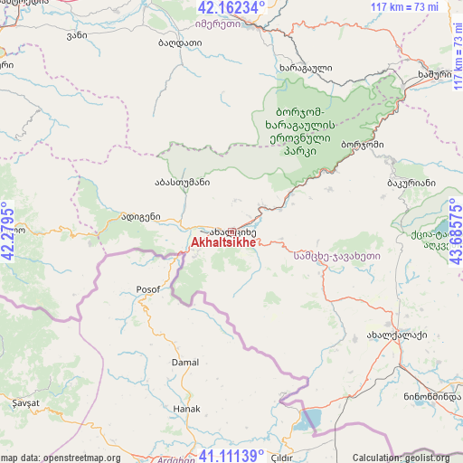
Akhaltsikhe GPS coordinates[2]
41° 38' 20.436" North, 42° 58' 57.432" East
| Map corner | latitude | longitude |
|---|---|---|
| Upper-left | 42.16234°, | 42.2795° |
| Center: | 41.63901°, | 42.98262° |
| Lower-right: | 41.11139°, | 43.68575° |
| Map W x H: | 116.9×116.9 km | = 72.6×72.6mi |
| max Lat: | 43.38111° ⇑82.9% North |
| Akhaltsikhe: | 41.63901° |
| min Lat: | ⇓17.1% South 41.21725° |
| min Long | Akhaltsikhe | max Long |
| 40.07944° | 42.98262° | 46.27667° |
| W 44.4%⇐ | ⇒55.6% E |
Elevation
Elevation of Akhaltsikhe is 984 m = 3228 ft, and this is 405.2 m = 1329 ft above average elevation for this country.
| Max E: |
2223 m = 7293 ft | 22.2% |
| Akhaltsikhe | 984 m 3228 ft | |
| Avg. | 578.8 m = 1899 ft | |
Min E: |
1 m = 3 ft | 77.8% |
See also: Georgia elevation on elevation.city.
Geographical zone
Akhaltsikhe is located in North temperate zone (between Tropic of Cancer and the Arctic Circle). Distance of this Northern Tropic circle is 2023.9 km =1257.6 mi to South.| Distance of | km | miles | from Akhaltsikhe |
|---|---|---|---|
| North Pole | 5377.2 | 3341.2 | to North |
| Arctic Circle | 2771.4 | 1722.1 | to North |
| Tropic Cancer | 2023.9 | 1257.6 | to South |
| Equator | 4629.8 | 2876.8 | to South |


Nearby cities:
15 places around Akhaltsikhe: (largest is in red/bold)
• Abastumani
13.7 km =8.5 mi,  303°
303°
• Adigeni
24.1 km =15 mi,  281°
281°
• Akhaldaba
52.9 km =32.9 mi,  52°
52°
• Akhalk’alak’i
49.3 km =30.6 mi,  121°
121°
• Aspindza
23.2 km =14.4 mi,  108°
108°
• Bakuriani
47.3 km =29.4 mi,  74°
74°
• Bakurianis Andeziti
42 km =26.1 mi,  75°
75°
• Borjomi
42.9 km =26.7 mi,  56°
56°
• Dioknisi
49.1 km =30.5 mi,  268°
268°
• Kharagauli
46.1 km =28.6 mi,  22°
22°
• Khert’visi
30.9 km =19.2 mi,  125°
125°
• Shorapani
50.9 km =31.6 mi,  9°
9°
• Tsaghveri
45.3 km =28.1 mi, 66°
• Vale
9.5 km =5.9 mi,  254°
254°
• Zestap’oni
52.7 km =32.7 mi, 6°
In other languages:
- In Spanish: Ajaltsije
- In France: Akhaltsikhé
- In Russian: Ахалцихе
- In Chinese: 阿哈爾齊赫
Sources, notices
• [Note1] Compared only with cities in Georgia existing in our database
• [Src1] Map data: © OpenStreetMap contributors (CC-BY-SA)
• [Src2] Other city data from geonames.org with taken over terms of usage.
• [Src3] Geographical zone / Annual Mean Temperature by Robert A. Rohde @ Wikipedia
