Dranda geodata
Dranda (Abkhazia) is a populated place; located in Georgia in Asia/Tbilisi (GMT+4) time zone. With population of 3,205 people, there are 68 cities with bigger population in this country. Compared to other cities in Georgia, 90.6% of cities are located further ↓South; 91.5% of cities are located further →East and 82.9% of cities have higher elevation than Dranda. Note1


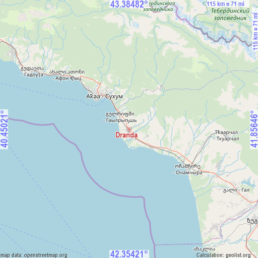
Dranda GPS coordinates[2]
42° 52' 18.012" North, 41° 9' 11.988" East
| Map corner | latitude | longitude |
|---|---|---|
| Upper-left | 43.38482°, | 40.45021° |
| Center: | 42.87167°, | 41.15333° |
| Lower-right: | 42.35421°, | 41.85646° |
| Map W x H: | 114.6×114.6 km | = 71.2×71.2mi |
| max Lat: | 43.38111° ⇑9.4% North |
| Dranda: | 42.87167° |
| min Lat: | ⇓90.6% South 41.21725° |
| min Long | Dranda | max Long |
| 40.07944° | 41.15333° | 46.27667° |
| W 8.5%⇐ | ⇒91.5% E |
Elevation
Elevation of Dranda is 25 m = 82 ft, and this is 553.8 m = 1817 ft below average elevation for this country.
| Max E: |
2223 m = 7293 ft | 82.9% |
| Avg. | 578.8 m = 1899 ft | |
| Dranda | 25 m = 82 ft | |
Min E: |
1 m = 3 ft | 17.1% |
See also: Georgia elevation on elevation.city.
Geographical zone
Dranda is located in North temperate zone (between Tropic of Cancer and the Arctic Circle). Distance of this Northern Tropic circle is 2161 km =1342.8 mi to South.| Distance of | km | miles | from Dranda |
|---|---|---|---|
| North Pole | 5240.2 | 3256.1 | to North |
| Arctic Circle | 2634.3 | 1636.9 | to North |
| Tropic Cancer | 2161 | 1342.8 | to South |
| Equator | 4766.9 | 2962 | to South |


Nearby cities:
15 places around Dranda: (largest is in red/bold)
• Bich’vinta
73.5 km =45.7 mi,  296°
296°
• Gali
55 km =34.2 mi,  119°
119°
• Gudauta
50.5 km =31.4 mi, 300°
• Gulrip’shi
7.7 km =4.8 mi,  322°
322°
• Jvari
75.3 km =46.8 mi,  103°
103°
• Kelasuri
13.7 km =8.5 mi,  330°
330°
• Likhni
53.5 km =33.2 mi, 304°
• Mokvi
27.5 km =17.1 mi, 103°
• Och’amch’ire
31.2 km =19.4 mi, 124°
• Orsant’ia
61.9 km =38.5 mi,  136°
136°
• P’rimorsk’oe
44.5 km =27.7 mi, 303°
• Sokhumi
20.1 km =12.5 mi, 318°
• Stantsiya Novyy Afon
34.6 km =21.5 mi,  312°
312°
• Tqvarch'eli
43.1 km =26.8 mi,  94°
94°
• Zugdidi
71.2 km =44.2 mi, 124°
Sources, notices
• [Note1] Compared only with cities in Georgia existing in our database
• [Src1] Map data: © OpenStreetMap contributors (CC-BY-SA)
• [Src2] Other city data from geonames.org with taken over terms of usage.
• [Src3] Geographical zone / Annual Mean Temperature by Robert A. Rohde @ Wikipedia
