Orsant’ia geodata
Orsant’ia (Samegrelo and Zemo Svaneti) is a populated place; located in Georgia in Asia/Tbilisi (GMT+4) time zone. With population of 1,200 people, there are 95 cities with bigger population in this country. Compared to other cities in Georgia, 76.9% of cities are located further ↓South; 86.3% of cities are located further →East and 89.7% of cities have higher elevation than Orsant’ia. Note1


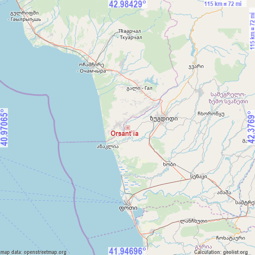
Orsant’ia GPS coordinates[2]
42° 28' 3.972" North, 41° 40' 25.572" East
| Map corner | latitude | longitude |
|---|---|---|
| Upper-left | 42.98429°, | 40.97065° |
| Center: | 42.46777°, | 41.67377° |
| Lower-right: | 41.94696°, | 42.3769° |
| Map W x H: | 115.3×115.3 km | = 71.6×71.6mi |
| max Lat: | 43.38111° ⇑23.1% North |
| Orsant’ia: | 42.46777° |
| min Lat: | ⇓76.9% South 41.21725° |
| min Long | Orsant’ia | max Long |
| 40.07944° | 41.67377° | 46.27667° |
| W 13.7%⇐ | ⇒86.3% E |
Elevation
Elevation of Orsant’ia is 17 m = 56 ft, and this is 561.8 m = 1843 ft below average elevation for this country.
| Max E: |
2223 m = 7293 ft | 89.7% |
| Avg. | 578.8 m = 1899 ft | |
| Orsant’ia | 17 m = 56 ft | |
Min E: |
1 m = 3 ft | 10.3% |
See also: Georgia elevation on elevation.city.
Geographical zone
Orsant’ia is located in North temperate zone (between Tropic of Cancer and the Arctic Circle). Distance of this Northern Tropic circle is 2116.1 km =1314.9 mi to South.| Distance of | km | miles | from Orsant’ia |
|---|---|---|---|
| North Pole | 5285.1 | 3284 | to North |
| Arctic Circle | 2679.2 | 1664.8 | to North |
| Tropic Cancer | 2116.1 | 1314.9 | to South |
| Equator | 4722 | 2934.1 | to South |


Nearby cities:
15 places around Orsant’ia: (largest is in red/bold)
• Abasha
53.4 km =33.2 mi,  122°
122°
• Gali
18.4 km =11.4 mi,  16°
16°
• Jvari
41.5 km =25.8 mi,  48°
48°
• Khobi
25.1 km =15.6 mi,  132°
132°
• Kveda Chkhorots’q’u
34.7 km =21.6 mi,  87°
87°
• Lanchkhuti
51.3 km =31.9 mi,  144°
144°
• Mart’vili
58.2 km =36.2 mi,  95°
95°
• Mokvi
41.6 km =25.8 mi,  337°
337°
• Och’amch’ire
32 km =19.9 mi,  328°
328°
• P’ot’i
35.8 km =22.2 mi,  180°
180°
• Senak’i
39.1 km =24.3 mi, 124°
• Tqvarch'eli
41.4 km =25.7 mi,  0°
0°
• Tsalenjikha
35.7 km =22.2 mi,  64°
64°
• Urek’i
53.2 km =33.1 mi,  170°
170°
• Zugdidi
16.8 km =10.4 mi,  74°
74°
Sources, notices
• [Note1] Compared only with cities in Georgia existing in our database
• [Src1] Map data: © OpenStreetMap contributors (CC-BY-SA)
• [Src2] Other city data from geonames.org with taken over terms of usage.
• [Src3] Geographical zone / Annual Mean Temperature by Robert A. Rohde @ Wikipedia
