No Kunda geodata
No Kunda (North Bank) is a populated place; located in Gambia in Africa/Banjul (GMT+0) time zone. With population of 1,913 people, there are 31 cities with bigger population in this country. Compared to other cities in Gambia, 84.6% of cities are located further ↓South; 75.6% of cities are located further →East and 74.8% of cities have higher elevation than No Kunda. Note1


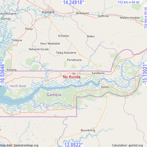
No Kunda GPS coordinates[2]
13° 34' 0.012" North, 15° 49' 59.988" West
| Map corner | latitude | longitude |
|---|---|---|
| Upper-left | 14.24918°, | -16.53646° |
| Center: | 13.56667°, | -15.83333° |
| Lower-right: | 12.8822°, | -15.13021° |
| Map W x H: | 152×152 km | = 94.4×94.4mi |
| max Lat: | 13.8° ⇑15.4% North |
| No Kunda: | 13.56667° |
| min Lat: | ⇓84.6% South 13.20194° |
| min Long | No Kunda | max Long |
| -16.73389° | -15.83333° | -13.85° |
| W 24.4%⇐ | ⇒75.6% E |
Elevation
Elevation of No Kunda is 14 m = 46 ft, and this is 7.1 m = 23 ft below average elevation for this country.
| Max E: |
49 m = 161 ft | 74.8% |
| Avg. | 21.1 m = 69 ft | |
| No Kunda | 14 m = 46 ft | |
Min E: |
1 m = 3 ft | 25.2% |
See also: Gambia elevation on elevation.city.
Geographical zone
No Kunda is located in North Torrid zone (between Equator and Tropic of Cancer). Distance of this Northern Tropic circle is 1097.4 km =681.9 mi to North.| Distance of | km | miles | from No Kunda |
|---|---|---|---|
| North Pole | 8498.6 | 5280.8 | to North |
| Arctic Circle | 5892.7 | 3661.6 | to North |
| Tropic Cancer | 1097.4 | 681.9 | to North |
| Equator | 1508.5 | 937.3 | to South |


Nearby cities:
15 places around No Kunda: (largest is in red/bold)
• Bantang Killing
14.5 km =9 mi,  82°
82°
• Daru Rilwan
16.3 km =10.1 mi,  263°
263°
• Dobo
14.5 km =9 mi, 262°
• Dumbutu
24.1 km =15 mi,  180°
180°
• Farafenni
25.2 km =15.7 mi,  90°
90°
• Gunjur
21.6 km =13.4 mi, 256°
• India
9 km =5.6 mi, 90°
• Jeriko
18.1 km =11.2 mi, 84°
• Jiroff
22 km =13.7 mi,  139°
139°
• Katchang
11.7 km =7.3 mi,  129°
129°
• Nioro
25.7 km =16 mi,  159°
159°
• Saba
24 km =14.9 mi, 256°
• Sibito
23.1 km =14.4 mi,  152°
152°
• Wurokang
20.5 km =12.7 mi,  174°
174°
• Yallal
14.5 km =9 mi,  97°
97°
Sources, notices
• [Note1] Compared only with cities in Gambia existing in our database
• [Src1] Map data: © OpenStreetMap contributors (CC-BY-SA)
• [Src2] Other city data from geonames.org with taken over terms of usage.
• [Src3] Geographical zone / Annual Mean Temperature by Robert A. Rohde @ Wikipedia
