Acharávi geodata
Acharávi (Ionian Islands) is a populated place; located in Greece in Europe/Athens (GMT+3) time zone. With population of 1,013 people, there are 1002 cities with bigger population in this country. Compared to other cities in Greece, 64.6% of cities are located further ↓South; 99.3% of cities are located further →East and 90.7% of cities have higher elevation than Acharávi. Note1


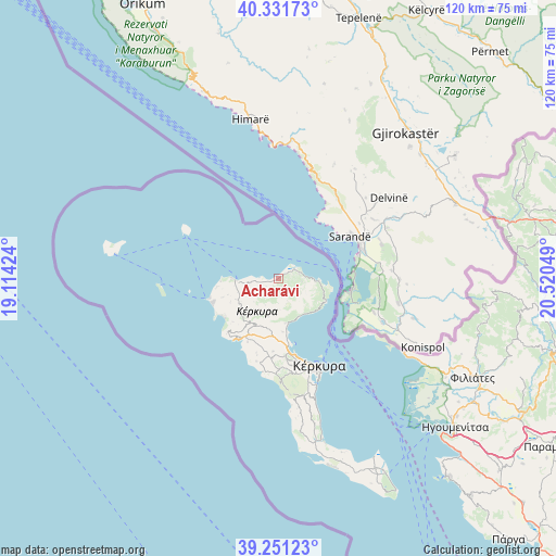
Acharávi GPS coordinates[2]
39° 47' 36.96" North, 19° 49' 2.496" East
| Map corner | latitude | longitude |
|---|---|---|
| Upper-left | 40.33173°, | 19.11424° |
| Center: | 39.7936°, | 19.81736° |
| Lower-right: | 39.25123°, | 20.52049° |
| Map W x H: | 120.1×120.1 km | = 74.6×74.6mi |
| max Lat: | 41.72048° ⇑35.4% North |
| Acharávi: | 39.7936° |
| min Lat: | ⇓64.6% South 34.8346° |
| min Long | Acharávi | max Long |
| 19.40494° | 19.81736° | 29.59361° |
| W 0.7%⇐ | ⇒99.3% E |
Elevation
Elevation of Acharávi is 8 m = 26 ft, and this is 160.9 m = 528 ft below average elevation for this country.
| Max E: |
1439 m = 4721 ft | 90.7% |
| Avg. | 168.9 m = 554 ft | |
| Acharávi | 8 m = 26 ft | |
Min E: |
0 m = 0 ft | 9.3% |
See also: Greece elevation on elevation.city.
Geographical zone
Acharávi is located in North temperate zone (between Tropic of Cancer and the Arctic Circle). Distance of this Northern Tropic circle is 1818.7 km =1130.1 mi to South.| Distance of | km | miles | from Acharávi |
|---|---|---|---|
| North Pole | 5582.4 | 3468.7 | to North |
| Arctic Circle | 2976.5 | 1849.5 | to North |
| Tropic Cancer | 1818.7 | 1130.1 | to South |
| Equator | 4424.6 | 2749.3 | to South |


Nearby cities:
15 places around Acharávi: (largest is in red/bold)
• Agios Georgis
12.7 km =7.9 mi,  232°
232°
• Avliótes
13.2 km =8.2 mi,  262°
262°
• Doukádes
13.3 km =8.3 mi,  209°
209°
• Karousádes
6.4 km =4 mi, 256°
• Kassiópi
8.9 km =5.5 mi,  93°
93°
• Kavvadádes
12.9 km =8 mi,  245°
245°
• Káto Agios Márkos
9.8 km =6.1 mi,  171°
171°
• Káto Korakiána
11.6 km =7.2 mi,  175°
175°
• Límni
14.7 km =9.1 mi, 169°
• Nýmfes
5 km =3.1 mi, 213°
• Perouládes
12.3 km =7.6 mi,  266°
266°
• Róda
2.2 km =1.4 mi, 250°
• Spartýlas
8.3 km =5.2 mi, 165°
• Ypsos
11.1 km =6.9 mi, 171°
• Áno Korakiána
10 km =6.2 mi,  192°
192°
Sources, notices
• [Note1] Compared only with cities in Greece existing in our database
• [Src1] Map data: © OpenStreetMap contributors (CC-BY-SA)
• [Src2] Other city data from geonames.org with taken over terms of usage.
• [Src3] Geographical zone / Annual Mean Temperature by Robert A. Rohde @ Wikipedia
