Gérakas geodata
Gérakas (Attica) is a seat of a third-order administrative division; located in Greece in Europe/Athens (GMT+3) time zone. With population of 29,939 people, there are 63 cities with bigger population in this country. Compared to other cities in Greece, 72.9% of cities are located further ↑North; 74.7% of cities are located further ←West and 78.1% of cities have lower elevation than Gérakas. Note1
Administrative division(s):
- Level 1: Attica
- Level 2: Nomarchía Anatolikís Attikís
- Level 3: Dimos Pallini


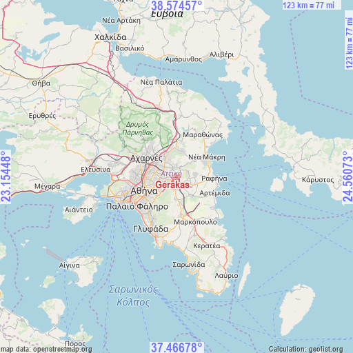
Gérakas GPS coordinates[2]
38° 1' 21.972" North, 23° 51' 27.36" East
| Map corner | latitude | longitude |
|---|---|---|
| Upper-left | 38.57457°, | 23.15448° |
| Center: | 38.02277°, | 23.8576° |
| Lower-right: | 37.46678°, | 24.56073° |
| Map W x H: | 123.2×123.2 km | = 76.6×76.6mi |
| max Lat: | 41.72048° ⇑72.9% North |
| Gérakas: | 38.02277° |
| min Lat: | ⇓27.1% South 34.8346° |
| min Long | Gérakas | max Long |
| 19.40494° | 23.8576° | 29.59361° |
| W 74.7%⇐ | ⇒25.3% E |
Elevation
Elevation of Gérakas is 250 m = 820 ft, and this is 81.1 m = 266 ft above average elevation for this country.
| Max E: |
1439 m = 4721 ft | 21.9% |
| Gérakas | 250 m 820 ft | |
| Avg. | 168.9 m = 554 ft | |
Min E: |
0 m = 0 ft | 78.1% |
See also: Greece elevation on elevation.city.
Geographical zone
Gérakas is located in North temperate zone (between Tropic of Cancer and the Arctic Circle). Distance of this Northern Tropic circle is 1621.8 km =1007.7 mi to South.| Distance of | km | miles | from Gérakas |
|---|---|---|---|
| North Pole | 5779.3 | 3591.1 | to North |
| Arctic Circle | 3173.4 | 1971.9 | to North |
| Tropic Cancer | 1621.8 | 1007.7 | to South |
| Equator | 4227.7 | 2627 | to South |


Nearby cities:
15 places around Gérakas: (largest is in red/bold)
• Agía Paraskeví
2.2 km =1.4 mi,  252°
252°
• Anthoúsa
1.7 km =1.1 mi,  79°
79°
• Argithéa
5.8 km =3.6 mi,  155°
155°
• Cholargós
5.6 km =3.5 mi,  243°
243°
• Dhráfi
4.4 km =2.7 mi,  88°
88°
• Dióni
6.6 km =4.1 mi, 89°
• Filothéi
6.6 km =4.1 mi,  272°
272°
• Khalándrion
5 km =3.1 mi, 271°
• Leondárion
4 km =2.5 mi,  183°
183°
• Maroúsi
5.9 km =3.7 mi,  300°
300°
• Melíssia
3.7 km =2.3 mi,  324°
324°
• Néa Pentéli
4.2 km =2.6 mi,  1°
1°
• Pallíni
3 km =1.9 mi,  131°
131°
• Pentéli
3.1 km =1.9 mi,  14°
14°
• Vrilissia
2.7 km =1.7 mi, 296°
Sources, notices
• [Note1] Compared only with cities in Greece existing in our database
• [Src1] Map data: © OpenStreetMap contributors (CC-BY-SA)
• [Src2] Other city data from geonames.org with taken over terms of usage.
• [Src3] Geographical zone / Annual Mean Temperature by Robert A. Rohde @ Wikipedia
