Leondárion geodata
Leondárion (Attica) is a populated place; located in Greece in Europe/Athens (GMT+3) time zone. With population of 5,929 people, there are 205 cities with bigger population in this country. Compared to other cities in Greece, 74.1% of cities are located further ↑North; 74.6% of cities are located further ←West and 74.7% of cities have lower elevation than Leondárion. Note1
Administrative division(s):
- Level 1: Attica
- Level 2: Nomarchía Anatolikís Attikís
- Level 3: Dimos Pallini


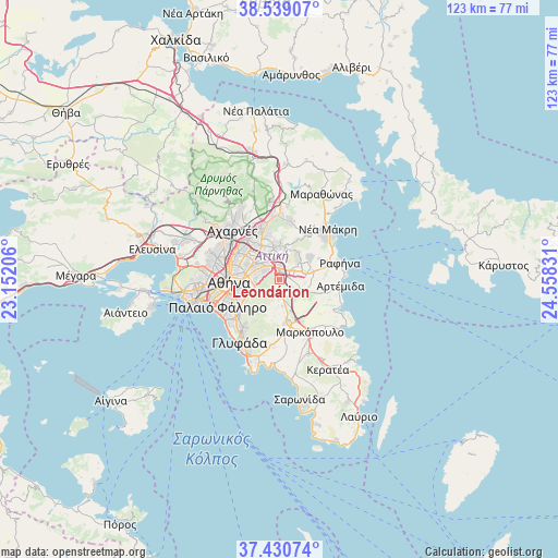
Leondárion GPS coordinates[2]
37° 59' 13.2" North, 23° 51' 18.648" East
| Map corner | latitude | longitude |
|---|---|---|
| Upper-left | 38.53907°, | 23.15206° |
| Center: | 37.987°, | 23.85518° |
| Lower-right: | 37.43074°, | 24.55831° |
| Map W x H: | 123.2×123.2 km | = 76.6×76.6mi |
| max Lat: | 41.72048° ⇑74.1% North |
| Leondárion: | 37.987° |
| min Lat: | ⇓25.9% South 34.8346° |
| min Long | Leondárion | max Long |
| 19.40494° | 23.85518° | 29.59361° |
| W 74.6%⇐ | ⇒25.4% E |
Elevation
Elevation of Leondárion is 207 m = 679 ft, and this is 38.1 m = 125 ft above average elevation for this country.
| Max E: |
1439 m = 4721 ft | 25.3% |
| Leondárion | 207 m 679 ft | |
| Avg. | 168.9 m = 554 ft | |
Min E: |
0 m = 0 ft | 74.7% |
See also: Greece elevation on elevation.city.
Geographical zone
Leondárion is located in North temperate zone (between Tropic of Cancer and the Arctic Circle). Distance of this Northern Tropic circle is 1617.8 km =1005.3 mi to South.| Distance of | km | miles | from Leondárion |
|---|---|---|---|
| North Pole | 5783.3 | 3593.6 | to North |
| Arctic Circle | 3177.4 | 1974.3 | to North |
| Tropic Cancer | 1617.8 | 1005.3 | to South |
| Equator | 4223.8 | 2624.5 | to South |


Nearby cities:
15 places around Leondárion: (largest is in red/bold)
• Agía Paraskeví
3.8 km =2.4 mi,  329°
329°
• Anthoúsa
4.7 km =2.9 mi,  23°
23°
• Argithéa
3 km =1.9 mi,  116°
116°
• Cholargós
5 km =3.1 mi,  286°
286°
• Christoúpoli
5.6 km =3.5 mi,  99°
99°
• Dhráfi
6.2 km =3.9 mi,  48°
48°
• Gérakas
4 km =2.5 mi,  3°
3°
• Karellás
5.9 km =3.7 mi,  171°
171°
• Khalándrion
6.3 km =3.9 mi,  310°
310°
• Néo Psychikó
6.6 km =4.1 mi, 288°
• Paianía
3.5 km =2.2 mi,  181°
181°
• Pallíni
3.2 km =2 mi, 50°
• Papágou
5.4 km =3.4 mi,  269°
269°
• Spáta
6 km =3.7 mi, 118°
• Vrilissia
5.7 km =3.5 mi,  336°
336°
Sources, notices
• [Note1] Compared only with cities in Greece existing in our database
• [Src1] Map data: © OpenStreetMap contributors (CC-BY-SA)
• [Src2] Other city data from geonames.org with taken over terms of usage.
• [Src3] Geographical zone / Annual Mean Temperature by Robert A. Rohde @ Wikipedia
