Gennadi geodata
Gennadi (South Aegean) is a populated place; located in Greece in Europe/Athens (GMT+3) time zone. With population of 655 people, there are 1490 cities with bigger population in this country. Compared to other cities in Greece, 93.7% of cities are located further ↑North; 99.4% of cities are located further ←West and 69.3% of cities have higher elevation than Gennadi. Note1


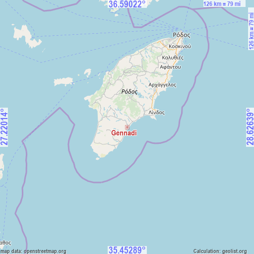
Gennadi GPS coordinates[2]
36° 1' 24.996" North, 27° 55' 23.736" East
| Map corner | latitude | longitude |
|---|---|---|
| Upper-left | 36.59022°, | 27.22014° |
| Center: | 36.02361°, | 27.92326° |
| Lower-right: | 35.45289°, | 28.62639° |
| Map W x H: | 126.5×126.5 km | = 78.6×78.6mi |
| max Lat: | 41.72048° ⇑93.7% North |
| Gennadi: | 36.02361° |
| min Lat: | ⇓6.3% South 34.8346° |
| min Long | Gennadi | max Long |
| 19.40494° | 27.92326° | 29.59361° |
| W 99.4%⇐ | ⇒0.59999999999999% E |
Elevation
Elevation of Gennadi is 33 m = 108 ft, and this is 135.9 m = 446 ft below average elevation for this country.
| Max E: |
1439 m = 4721 ft | 69.3% |
| Avg. | 168.9 m = 554 ft | |
| Gennadi | 33 m = 108 ft | |
Min E: |
0 m = 0 ft | 30.7% |
See also: Greece elevation on elevation.city.
Geographical zone
Gennadi is located in North temperate zone (between Tropic of Cancer and the Arctic Circle). Distance of this Northern Tropic circle is 1399.5 km =869.6 mi to South.| Distance of | km | miles | from Gennadi |
|---|---|---|---|
| North Pole | 6001.6 | 3729.2 | to North |
| Arctic Circle | 3395.7 | 2110 | to North |
| Tropic Cancer | 1399.5 | 869.6 | to South |
| Equator | 4005.4 | 2488.8 | to South |


Nearby cities:
15 places around Gennadi: (largest is in red/bold)
• Afántou
36.9 km =22.9 mi,  35°
35°
• Apóllona
26.7 km =16.6 mi,  8°
8°
• Archángelos
27.4 km =17 mi, 38°
• Chálki
35.6 km =22.1 mi,  308°
308°
• Dhamatria
42.2 km =26.2 mi,  19°
19°
• Faliraki
43 km =26.7 mi, 35°
• Fanes
36.8 km =22.9 mi, 8°
• Ialysós
48.1 km =29.9 mi,  25°
25°
• Kremastí
46.4 km =28.8 mi, 22°
• Lárdos
11.4 km =7.1 mi,  46°
46°
• Líndos
16.4 km =10.2 mi,  62°
62°
• Megálo Chorió
70.6 km =43.9 mi, 312°
• Ródos
53.1 km =33 mi, 30°
• Sými
66.3 km =41.2 mi,  353°
353°
• Émponas
23.4 km =14.5 mi, 345°
Sources, notices
• [Note1] Compared only with cities in Greece existing in our database
• [Src1] Map data: © OpenStreetMap contributors (CC-BY-SA)
• [Src2] Other city data from geonames.org with taken over terms of usage.
• [Src3] Geographical zone / Annual Mean Temperature by Robert A. Rohde @ Wikipedia
