Sými geodata
Sými (South Aegean) is a seat of a third-order administrative division; located in Greece in Europe/Athens (GMT+3) time zone. With population of 2,354 people, there are 445 cities with bigger population in this country. Compared to other cities in Greece, 92.3% of cities are located further ↑North; 99.2% of cities are located further ←West and 97.4% of cities have higher elevation than Sými. Note1


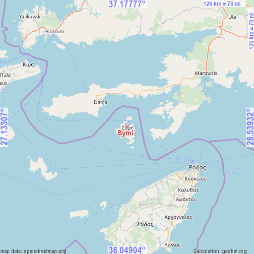
Sými GPS coordinates[2]
36° 36' 55.692" North, 27° 50' 10.284" East
| Map corner | latitude | longitude |
|---|---|---|
| Upper-left | 37.17777°, | 27.13307° |
| Center: | 36.61547°, | 27.83619° |
| Lower-right: | 36.04904°, | 28.53932° |
| Map W x H: | 125.5×125.5 km | = 78×78mi |
| max Lat: | 41.72048° ⇑92.3% North |
| Sými: | 36.61547° |
| min Lat: | ⇓7.7% South 34.8346° |
| min Long | Sými | max Long |
| 19.40494° | 27.83619° | 29.59361° |
| W 99.2%⇐ | ⇒0.8% E |
Elevation
Elevation of Sými is 4 m = 13 ft, and this is 164.9 m = 541 ft below average elevation for this country.
| Max E: |
1439 m = 4721 ft | 97.4% |
| Avg. | 168.9 m = 554 ft | |
| Sými | 4 m = 13 ft | |
Min E: |
0 m = 0 ft | 2.6% |
See also: Greece elevation on elevation.city.
Geographical zone
Sými is located in North temperate zone (between Tropic of Cancer and the Arctic Circle). Distance of this Northern Tropic circle is 1465.3 km =910.5 mi to South.| Distance of | km | miles | from Sými |
|---|---|---|---|
| North Pole | 5935.8 | 3688.3 | to North |
| Arctic Circle | 3329.9 | 2069.1 | to North |
| Tropic Cancer | 1465.3 | 910.5 | to South |
| Equator | 4071.3 | 2529.8 | to South |


Nearby cities:
15 places around Sými: (largest is in red/bold)
• Afántou
46.2 km =28.7 mi,  140°
140°
• Apóllona
41.1 km =25.5 mi,  163°
163°
• Archángelos
51 km =31.7 mi,  150°
150°
• Chálki
48.1 km =29.9 mi,  204°
204°
• Dhamatria
34.2 km =21.3 mi, 139°
• Faliraki
44.7 km =27.8 mi,  133°
133°
• Fanes
32.2 km =20 mi, 155°
• Ialysós
36.3 km =22.6 mi, 128°
• Kos
57.8 km =35.9 mi,  302°
302°
• Kremastí
34.1 km =21.2 mi, 132°
• Lárdos
60.1 km =37.3 mi, 164°
• Líndos
62.4 km =38.8 mi, 159°
• Megálo Chorió
47.3 km =29.4 mi,  247°
247°
• Ródos
39.9 km =24.8 mi,  120°
120°
• Émponas
43.3 km =26.9 mi,  177°
177°
Sources, notices
• [Note1] Compared only with cities in Greece existing in our database
• [Src1] Map data: © OpenStreetMap contributors (CC-BY-SA)
• [Src2] Other city data from geonames.org with taken over terms of usage.
• [Src3] Geographical zone / Annual Mean Temperature by Robert A. Rohde @ Wikipedia
