Ialysós geodata
Ialysós (South Aegean) is a populated place; located in Greece in Europe/Athens (GMT+3) time zone. With population of 11,473 people, there are 130 cities with bigger population in this country. Compared to other cities in Greece, 92.7% of cities are located further ↑North; 99.8% of cities are located further ←West and 81.5% of cities have higher elevation than Ialysós. Note1


Ialysós GPS coordinates[2]
36° 24' 48.672" North, 28° 9' 18.576" East
| Map corner | latitude | longitude |
|---|---|---|
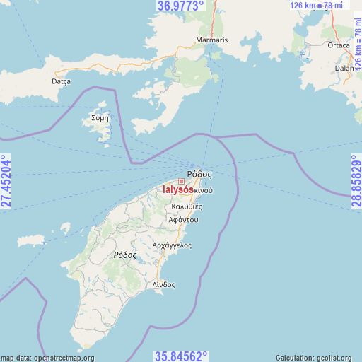
| Upper-left | 36.9773°, | 27.45204° |
| Center: | 36.41352°, | 28.15516° |
| Lower-right: | 35.84562°, | 28.85829° |
| Map W x H: | 125.8×125.8 km | = 78.2×78.2mi |
| max Lat: | 41.72048° ⇑92.7% North |
| Ialysós: | 36.41352° |
| min Lat: | ⇓7.3% South 34.8346° |
| min Long | Ialysós | max Long |
| 19.40494° | 28.15516° | 29.59361° |
| W 99.8%⇐ | ⇒0.2% E |
Elevation
Elevation of Ialysós is 16 m = 52 ft, and this is 152.9 m = 502 ft below average elevation for this country.
| Max E: |
1439 m = 4721 ft | 81.5% |
| Avg. | 168.9 m = 554 ft | |
| Ialysós | 16 m = 52 ft | |
Min E: |
0 m = 0 ft | 18.5% |
See also: Greece elevation on elevation.city.
Geographical zone
Ialysós is located in North temperate zone (between Tropic of Cancer and the Arctic Circle). Distance of this Northern Tropic circle is 1442.9 km =896.6 mi to South.| Distance of | km | miles | from Ialysós |
|---|---|---|---|
| North Pole | 5958.3 | 3702.3 | to North |
| Arctic Circle | 3352.4 | 2083.1 | to North |
| Tropic Cancer | 1442.9 | 896.6 | to South |
| Equator | 4048.8 | 2515.8 | to South |


Nearby cities:
15 places around Ialysós: (largest is in red/bold)
• Afántou
13.4 km =8.3 mi,  177°
177°
• Apóllona
23.9 km =14.9 mi,  224°
224°
• Archángelos
22.4 km =13.9 mi,  189°
189°
• Chálki
53.1 km =33 mi,  246°
246°
• Dhamatria
7.5 km =4.7 mi,  240°
240°
• Faliraki
9.1 km =5.7 mi,  154°
154°
• Fanes
16.9 km =10.5 mi, 245°
• Gennadi
48.1 km =29.9 mi,  205°
205°
• Kremastí
3.2 km =2 mi,  262°
262°
• Lárdos
37.6 km =23.4 mi,  199°
199°
• Líndos
36.4 km =22.6 mi, 189°
• Megálo Chorió
72.6 km =45.1 mi,  273°
273°
• Ródos
6.5 km =4 mi,  67°
67°
• Sými
36.3 km =22.6 mi,  308°
308°
• Émponas
33.9 km =21.1 mi,  232°
232°
Sources, notices
• [Note1] Compared only with cities in Greece existing in our database
• [Src1] Map data: © OpenStreetMap contributors (CC-BY-SA)
• [Src2] Other city data from geonames.org with taken over terms of usage.
• [Src3] Geographical zone / Annual Mean Temperature by Robert A. Rohde @ Wikipedia
