Vatsouniá geodata
Vatsouniá (Thessaly) is a populated place; located in Greece in Europe/Athens (GMT+3) time zone. With population of 615 people, there are 1557 cities with bigger population in this country. Compared to other cities in Greece, 54.1% of cities are located further ↓South; 81.4% of cities are located further →East and 87.7% of cities have lower elevation than Vatsouniá. Note1


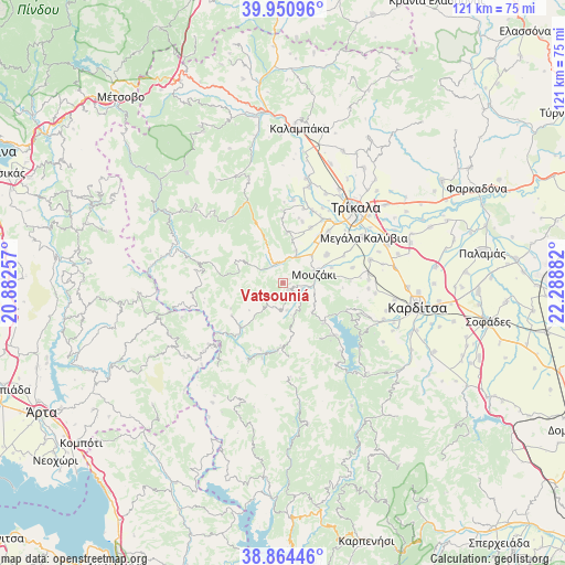
Vatsouniá GPS coordinates[2]
39° 24' 35.388" North, 21° 35' 8.484" East
| Map corner | latitude | longitude |
|---|---|---|
| Upper-left | 39.95096°, | 20.88257° |
| Center: | 39.40983°, | 21.58569° |
| Lower-right: | 38.86446°, | 22.28882° |
| Map W x H: | 120.8×120.8 km | = 75.1×75.1mi |
| max Lat: | 41.72048° ⇑45.9% North |
| Vatsouniá: | 39.40983° |
| min Lat: | ⇓54.1% South 34.8346° |
| min Long | Vatsouniá | max Long |
| 19.40494° | 21.58569° | 29.59361° |
| W 18.6%⇐ | ⇒81.4% E |
Elevation
Elevation of Vatsouniá is 451 m = 1480 ft, and this is 282.1 m = 926 ft above average elevation for this country.
| Max E: |
1439 m = 4721 ft | 12.3% |
| Vatsouniá | 451 m 1480 ft | |
| Avg. | 168.9 m = 554 ft | |
Min E: |
0 m = 0 ft | 87.7% |
See also: Greece elevation on elevation.city.
Geographical zone
Vatsouniá is located in North temperate zone (between Tropic of Cancer and the Arctic Circle). Distance of this Northern Tropic circle is 1776 km =1103.6 mi to South.| Distance of | km | miles | from Vatsouniá |
|---|---|---|---|
| North Pole | 5625.1 | 3495.3 | to North |
| Arctic Circle | 3019.2 | 1876 | to North |
| Tropic Cancer | 1776 | 1103.6 | to South |
| Equator | 4382 | 2722.8 | to South |


Nearby cities:
15 places around Vatsouniá: (largest is in red/bold)
• Anthiró
13 km =8.1 mi,  237°
237°
• Drakótrypa
1.8 km =1.1 mi,  139°
139°
• Eleftherochóri
13.7 km =8.5 mi,  17°
17°
• Eláti
10.9 km =6.8 mi,  338°
338°
• Fíki
13.2 km =8.2 mi,  26°
26°
• Gelánthi
10.9 km =6.8 mi,  72°
72°
• Gómfoi
11 km =6.8 mi,  56°
56°
• Lygariá
12.6 km =7.8 mi,  41°
41°
• Mavrommáti
9.4 km =5.8 mi,  80°
80°
• Mouzáki
7 km =4.3 mi, 71°
• Palaiomonástiro
8.5 km =5.3 mi,  46°
46°
• Piáleia
10.7 km =6.6 mi,  4°
4°
• Pýli
6.1 km =3.8 mi, 27°
• Stournaraíïka
9.5 km =5.9 mi,  300°
300°
• Ágios Vissaríonas
7.4 km =4.6 mi, 22°
Sources, notices
• [Note1] Compared only with cities in Greece existing in our database
• [Src1] Map data: © OpenStreetMap contributors (CC-BY-SA)
• [Src2] Other city data from geonames.org with taken over terms of usage.
• [Src3] Geographical zone / Annual Mean Temperature by Robert A. Rohde @ Wikipedia
