Solomós geodata
Solomós (Peloponnese) is a populated place; located in Greece in Europe/Athens (GMT+3) time zone. With population of 743 people, there are 1342 cities with bigger population in this country. Compared to other cities in Greece, 78.2% of cities are located further ↑North; 51.5% of cities are located further ←West and 59.3% of cities have lower elevation than Solomós. Note1


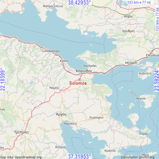
Solomós GPS coordinates[2]
37° 52' 35.832" North, 22° 53' 20.796" East
| Map corner | latitude | longitude |
|---|---|---|
| Upper-left | 38.42953°, | 22.18599° |
| Center: | 37.87662°, | 22.88911° |
| Lower-right: | 37.31953°, | 23.59224° |
| Map W x H: | 123.4×123.4 km | = 76.7×76.7mi |
| max Lat: | 41.72048° ⇑78.2% North |
| Solomós: | 37.87662° |
| min Lat: | ⇓21.8% South 34.8346° |
| min Long | Solomós | max Long |
| 19.40494° | 22.88911° | 29.59361° |
| W 51.5%⇐ | ⇒48.5% E |
Elevation
Elevation of Solomós is 114 m = 374 ft, and this is 54.9 m = 180 ft below average elevation for this country.
| Max E: |
1439 m = 4721 ft | 40.7% |
| Avg. | 168.9 m = 554 ft | |
| Solomós | 114 m = 374 ft | |
Min E: |
0 m = 0 ft | 59.3% |
See also: Greece elevation on elevation.city.
Geographical zone
Solomós is located in North temperate zone (between Tropic of Cancer and the Arctic Circle). Distance of this Northern Tropic circle is 1605.6 km =997.7 mi to South.| Distance of | km | miles | from Solomós |
|---|---|---|---|
| North Pole | 5795.6 | 3601.2 | to North |
| Arctic Circle | 3189.7 | 1982 | to North |
| Tropic Cancer | 1605.6 | 997.7 | to South |
| Equator | 4211.5 | 2616.9 | to South |


Nearby cities:
15 places around Solomós: (largest is in red/bold)
• Archaío Limáni
6 km =3.7 mi,  3°
3°
• Arkhaía Kórinthos
3.7 km =2.3 mi,  352°
352°
• Athíkia
7.5 km =4.7 mi,  152°
152°
• Examília
4.1 km =2.5 mi,  56°
56°
• Khiliomódhi
7.6 km =4.7 mi,  192°
192°
• Kyrás Vrýsi
9.5 km =5.9 mi, 64°
• Káto Examília
5.6 km =3.5 mi,  52°
52°
• Káto Ássos
9.4 km =5.8 mi,  326°
326°
• Kórinthos
8.9 km =5.5 mi,  37°
37°
• Loutrá Oraías Elénis
9.5 km =5.9 mi,  98°
98°
• Lékhaio
7.1 km =4.4 mi, 331°
• Periyiáli
8.3 km =5.2 mi, 328°
• Xilokériza
4.7 km =2.9 mi,  82°
82°
• Zevgolateió
10 km =6.2 mi,  308°
308°
• Ássos
9.1 km =5.7 mi,  320°
320°
Sources, notices
• [Note1] Compared only with cities in Greece existing in our database
• [Src1] Map data: © OpenStreetMap contributors (CC-BY-SA)
• [Src2] Other city data from geonames.org with taken over terms of usage.
• [Src3] Geographical zone / Annual Mean Temperature by Robert A. Rohde @ Wikipedia
