Lékhaio geodata
Lékhaio (Peloponnese) is a populated place; located in Greece in Europe/Athens (GMT+3) time zone. With population of 2,643 people, there are 398 cities with bigger population in this country. Compared to other cities in Greece, 76.9% of cities are located further ↑North; 50.2% of cities are located further →East and 79.3% of cities have higher elevation than Lékhaio. Note1


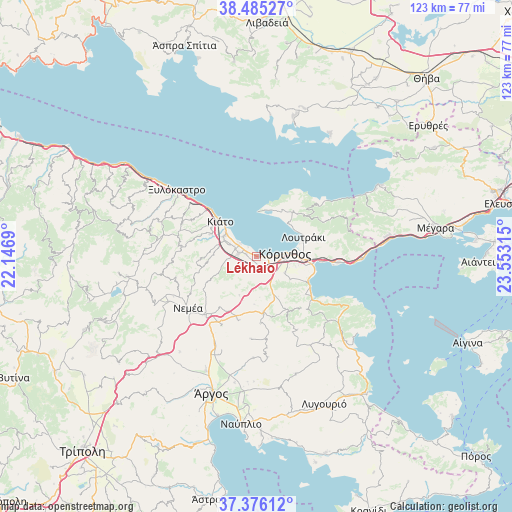
Lékhaio GPS coordinates[2]
37° 55' 58.044" North, 22° 51' 0.072" East
| Map corner | latitude | longitude |
|---|---|---|
| Upper-left | 38.48527°, | 22.1469° |
| Center: | 37.93279°, | 22.85002° |
| Lower-right: | 37.37612°, | 23.55315° |
| Map W x H: | 123.3×123.3 km | = 76.6×76.6mi |
| max Lat: | 41.72048° ⇑76.9% North |
| Lékhaio: | 37.93279° |
| min Lat: | ⇓23.1% South 34.8346° |
| min Long | Lékhaio | max Long |
| 19.40494° | 22.85002° | 29.59361° |
| W 49.8%⇐ | ⇒50.2% E |
Elevation
Elevation of Lékhaio is 18 m = 59 ft, and this is 150.9 m = 495 ft below average elevation for this country.
| Max E: |
1439 m = 4721 ft | 79.3% |
| Avg. | 168.9 m = 554 ft | |
| Lékhaio | 18 m = 59 ft | |
Min E: |
0 m = 0 ft | 20.7% |
See also: Greece elevation on elevation.city.
Geographical zone
Lékhaio is located in North temperate zone (between Tropic of Cancer and the Arctic Circle). Distance of this Northern Tropic circle is 1611.8 km =1001.5 mi to South.| Distance of | km | miles | from Lékhaio |
|---|---|---|---|
| North Pole | 5789.3 | 3597.3 | to North |
| Arctic Circle | 3183.4 | 1978.1 | to North |
| Tropic Cancer | 1611.8 | 1001.5 | to South |
| Equator | 4217.7 | 2620.8 | to South |


Nearby cities:
15 places around Lékhaio: (largest is in red/bold)
• Archaío Limáni
3.8 km =2.4 mi,  93°
93°
• Arkhaía Kórinthos
3.9 km =2.4 mi,  131°
131°
• Boláti
5.8 km =3.6 mi,  296°
296°
• Examília
7.9 km =4.9 mi,  119°
119°
• Kokkónion
7.4 km =4.6 mi, 304°
• Káto Examília
8.4 km =5.2 mi,  109°
109°
• Káto Ássos
2.4 km =1.5 mi,  313°
313°
• Nerántza
8.3 km =5.2 mi, 313°
• Periyiáli
1.3 km =0.8 mi, 312°
• Poullítsa
7.5 km =4.7 mi,  292°
292°
• Solomós
7.1 km =4.4 mi,  151°
151°
• Vokhaïkó
5.4 km =3.4 mi, 288°
• Vrakháti
4.9 km =3 mi, 306°
• Zevgolateió
4.4 km =2.7 mi,  270°
270°
• Ássos
2.6 km =1.6 mi, 287°
Sources, notices
• [Note1] Compared only with cities in Greece existing in our database
• [Src1] Map data: © OpenStreetMap contributors (CC-BY-SA)
• [Src2] Other city data from geonames.org with taken over terms of usage.
• [Src3] Geographical zone / Annual Mean Temperature by Robert A. Rohde @ Wikipedia
