Periyiáli geodata
Periyiáli (Peloponnese) is a populated place; located in Greece in Europe/Athens (GMT+3) time zone. With population of 1,616 people, there are 619 cities with bigger population in this country. Compared to other cities in Greece, 76.4% of cities are located further ↑North; 50.5% of cities are located further →East and 87.7% of cities have higher elevation than Periyiáli. Note1


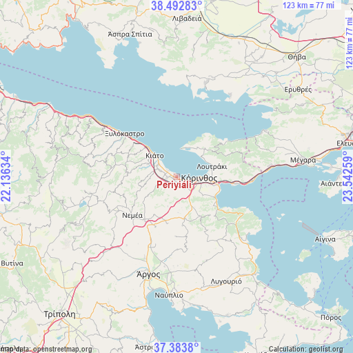
Periyiáli GPS coordinates[2]
37° 56' 25.476" North, 22° 50' 22.056" East
| Map corner | latitude | longitude |
|---|---|---|
| Upper-left | 38.49283°, | 22.13634° |
| Center: | 37.94041°, | 22.83946° |
| Lower-right: | 37.3838°, | 23.54259° |
| Map W x H: | 123.3×123.3 km | = 76.6×76.6mi |
| max Lat: | 41.72048° ⇑76.4% North |
| Periyiáli: | 37.94041° |
| min Lat: | ⇓23.6% South 34.8346° |
| min Long | Periyiáli | max Long |
| 19.40494° | 22.83946° | 29.59361° |
| W 49.5%⇐ | ⇒50.5% E |
Elevation
Elevation of Periyiáli is 10 m = 33 ft, and this is 158.9 m = 521 ft below average elevation for this country.
| Max E: |
1439 m = 4721 ft | 87.7% |
| Avg. | 168.9 m = 554 ft | |
| Periyiáli | 10 m = 33 ft | |
Min E: |
0 m = 0 ft | 12.3% |
See also: Greece elevation on elevation.city.
Geographical zone
Periyiáli is located in North temperate zone (between Tropic of Cancer and the Arctic Circle). Distance of this Northern Tropic circle is 1612.7 km =1002.1 mi to South.| Distance of | km | miles | from Periyiáli |
|---|---|---|---|
| North Pole | 5788.5 | 3596.8 | to North |
| Arctic Circle | 3182.6 | 1977.6 | to North |
| Tropic Cancer | 1612.7 | 1002.1 | to South |
| Equator | 4218.6 | 2621.3 | to South |


Nearby cities:
15 places around Periyiáli: (largest is in red/bold)
• Archaío Limáni
4.8 km =3 mi,  103°
103°
• Arkhaía Kórinthos
5.2 km =3.2 mi,  131°
131°
• Boláti
4.6 km =2.9 mi,  292°
292°
• Kokkónion
6.2 km =3.9 mi,  302°
302°
• Krínes
7.4 km =4.6 mi, 292°
• Káto Ássos
1.1 km =0.7 mi,  314°
314°
• Lékhaio
1.3 km =0.8 mi, 132°
• Nerántza
7 km =4.3 mi, 313°
• Poullítsa
6.3 km =3.9 mi, 289°
• Solomós
8.3 km =5.2 mi,  148°
148°
• Vokhaïkó
4.3 km =2.7 mi,  282°
282°
• Vrakháti
3.6 km =2.2 mi, 304°
• Vélo
8 km =5 mi, 299°
• Zevgolateió
3.5 km =2.2 mi,  257°
257°
• Ássos
1.5 km =0.9 mi,  266°
266°
Sources, notices
• [Note1] Compared only with cities in Greece existing in our database
• [Src1] Map data: © OpenStreetMap contributors (CC-BY-SA)
• [Src2] Other city data from geonames.org with taken over terms of usage.
• [Src3] Geographical zone / Annual Mean Temperature by Robert A. Rohde @ Wikipedia
