Pródromos geodata
Pródromos (Thessaly) is a populated place; located in Greece in Europe/Athens (GMT+3) time zone. With population of 994 people, there are 1022 cities with bigger population in this country. Compared to other cities in Greece, 53.2% of cities are located further ↓South; 72.8% of cities are located further →East and 55.5% of cities have lower elevation than Pródromos. Note1


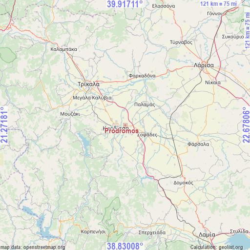
Pródromos GPS coordinates[2]
39° 22' 32.556" North, 21° 58' 29.748" East
| Map corner | latitude | longitude |
|---|---|---|
| Upper-left | 39.91711°, | 21.27181° |
| Center: | 39.37571°, | 21.97493° |
| Lower-right: | 38.83008°, | 22.67806° |
| Map W x H: | 120.9×120.9 km | = 75.1×75.1mi |
| max Lat: | 41.72048° ⇑46.8% North |
| Pródromos: | 39.37571° |
| min Lat: | ⇓53.2% South 34.8346° |
| min Long | Pródromos | max Long |
| 19.40494° | 21.97493° | 29.59361° |
| W 27.2%⇐ | ⇒72.8% E |
Elevation
Elevation of Pródromos is 100 m = 328 ft, and this is 68.9 m = 226 ft below average elevation for this country.
| Max E: |
1439 m = 4721 ft | 44.5% |
| Avg. | 168.9 m = 554 ft | |
| Pródromos | 100 m = 328 ft | |
Min E: |
0 m = 0 ft | 55.5% |
See also: Greece elevation on elevation.city.
Geographical zone
Pródromos is located in North temperate zone (between Tropic of Cancer and the Arctic Circle). Distance of this Northern Tropic circle is 1772.2 km =1101.2 mi to South.| Distance of | km | miles | from Pródromos |
|---|---|---|---|
| North Pole | 5628.9 | 3497.6 | to North |
| Arctic Circle | 3023 | 1878.4 | to North |
| Tropic Cancer | 1772.2 | 1101.2 | to South |
| Equator | 4378.2 | 2720.5 | to South |


Nearby cities:
15 places around Pródromos: (largest is in red/bold)
• Artesianó
7.3 km =4.5 mi,  293°
293°
• Frágko
11.5 km =7.1 mi,  259°
259°
• Georgikó
10.8 km =6.7 mi,  243°
243°
• Kallifóni
11 km =6.8 mi,  186°
186°
• Karditsomagoúla
4.7 km =2.9 mi, 290°
• Kardítsa
4.7 km =2.9 mi, 255°
• Karpochóri
5.4 km =3.4 mi,  144°
144°
• Krýa Vrýsi
10.5 km =6.5 mi, 236°
• Makrychóri
7.2 km =4.5 mi,  353°
353°
• Mavrika
4.7 km =2.9 mi,  218°
218°
• Mýrina
3.7 km =2.3 mi,  343°
343°
• Palaiokklísi
9.5 km =5.9 mi,  270°
270°
• Roússo
9.4 km =5.8 mi, 220°
• Stavrós
1.5 km =0.9 mi, 189°
• Zaḯmi
9 km =5.6 mi,  199°
199°
Sources, notices
• [Note1] Compared only with cities in Greece existing in our database
• [Src1] Map data: © OpenStreetMap contributors (CC-BY-SA)
• [Src2] Other city data from geonames.org with taken over terms of usage.
• [Src3] Geographical zone / Annual Mean Temperature by Robert A. Rohde @ Wikipedia
