Kardítsa geodata
Kardítsa (Thessaly) is a seat of a second-order administrative division; located in Greece in Europe/Athens (GMT+3) time zone. With population of 32,789 people, there are 55 cities with bigger population in this country. Compared to other cities in Greece, 52.9% of cities are located further ↓South; 73.8% of cities are located further →East and 58.4% of cities have lower elevation than Kardítsa. Note1


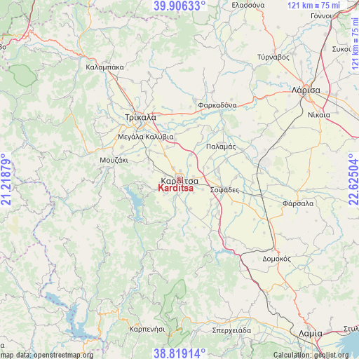
Kardítsa GPS coordinates[2]
39° 21' 53.46" North, 21° 55' 18.876" East
| Map corner | latitude | longitude |
|---|---|---|
| Upper-left | 39.90633°, | 21.21879° |
| Center: | 39.36485°, | 21.92191° |
| Lower-right: | 38.81914°, | 22.62504° |
| Map W x H: | 120.9×120.9 km | = 75.1×75.1mi |
| max Lat: | 41.72048° ⇑47.1% North |
| Kardítsa: | 39.36485° |
| min Lat: | ⇓52.9% South 34.8346° |
| min Long | Kardítsa | max Long |
| 19.40494° | 21.92191° | 29.59361° |
| W 26.2%⇐ | ⇒73.8% E |
Elevation
Elevation of Kardítsa is 111 m = 364 ft, and this is 57.9 m = 190 ft below average elevation for this country.
| Max E: |
1439 m = 4721 ft | 41.6% |
| Avg. | 168.9 m = 554 ft | |
| Kardítsa | 111 m = 364 ft | |
Min E: |
0 m = 0 ft | 58.4% |
See also: Greece elevation on elevation.city.
Geographical zone
Kardítsa is located in North temperate zone (between Tropic of Cancer and the Arctic Circle). Distance of this Northern Tropic circle is 1771 km =1100.4 mi to South.| Distance of | km | miles | from Kardítsa |
|---|---|---|---|
| North Pole | 5630.1 | 3498.4 | to North |
| Arctic Circle | 3024.2 | 1879.2 | to North |
| Tropic Cancer | 1771 | 1100.4 | to South |
| Equator | 4377 | 2719.7 | to South |


Nearby cities:
15 places around Kardítsa: (largest is in red/bold)
• Artesianó
4.7 km =2.9 mi,  332°
332°
• Frágko
6.8 km =4.2 mi,  262°
262°
• Georgikó
6.2 km =3.9 mi,  234°
234°
• Karditsomagoúla
2.9 km =1.8 mi,  2°
2°
• Karpochóri
8.3 km =5.2 mi,  112°
112°
• Krýa Vrýsi
6.2 km =3.9 mi,  222°
222°
• Mavrika
3 km =1.9 mi,  146°
146°
• Mitrópoli
7.8 km =4.8 mi,  248°
248°
• Mýrina
5.9 km =3.7 mi,  36°
36°
• Palaiokklísi
5.1 km =3.2 mi,  284°
284°
• Pródromos
4.7 km =2.9 mi,  75°
75°
• Roússo
6.1 km =3.8 mi,  194°
194°
• Stavrós
4.3 km =2.7 mi,  94°
94°
• Xinonéri
7.4 km =4.6 mi, 225°
• Zaḯmi
7.4 km =4.6 mi,  168°
168°
Sources, notices
• [Note1] Compared only with cities in Greece existing in our database
• [Src1] Map data: © OpenStreetMap contributors (CC-BY-SA)
• [Src2] Other city data from geonames.org with taken over terms of usage.
• [Src3] Geographical zone / Annual Mean Temperature by Robert A. Rohde @ Wikipedia
