Pérama geodata
Pérama (Attica) is a seat of a third-order administrative division; located in Greece in Europe/Athens (GMT+3) time zone. With population of 25,389 people, there are 76 cities with bigger population in this country. Compared to other cities in Greece, 75% of cities are located further ↑North; 65.7% of cities are located further ←West and 52.8% of cities have higher elevation than Pérama. Note1


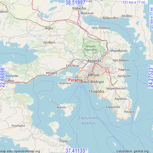
Pérama GPS coordinates[2]
37° 58' 3.9" North, 23° 34' 19.56" East
| Map corner | latitude | longitude |
|---|---|---|
| Upper-left | 38.51997°, | 22.86898° |
| Center: | 37.96775°, | 23.5721° |
| Lower-right: | 37.41135°, | 24.27523° |
| Map W x H: | 123.3×123.3 km | = 76.6×76.6mi |
| max Lat: | 41.72048° ⇑75% North |
| Pérama: | 37.96775° |
| min Lat: | ⇓25% South 34.8346° |
| min Long | Pérama | max Long |
| 19.40494° | 23.5721° | 29.59361° |
| W 65.7%⇐ | ⇒34.3% E |
Elevation
Elevation of Pérama is 71 m = 233 ft, and this is 97.9 m = 321 ft below average elevation for this country.
| Max E: |
1439 m = 4721 ft | 52.8% |
| Avg. | 168.9 m = 554 ft | |
| Pérama | 71 m = 233 ft | |
Min E: |
0 m = 0 ft | 47.2% |
See also: Greece elevation on elevation.city.
Geographical zone
Pérama is located in North temperate zone (between Tropic of Cancer and the Arctic Circle). Distance of this Northern Tropic circle is 1615.7 km =1003.9 mi to South.| Distance of | km | miles | from Pérama |
|---|---|---|---|
| North Pole | 5785.4 | 3594.9 | to North |
| Arctic Circle | 3179.6 | 1975.7 | to North |
| Tropic Cancer | 1615.7 | 1003.9 | to South |
| Equator | 4221.6 | 2623.2 | to South |


Nearby cities:
15 places around Pérama: (largest is in red/bold)
• Agios Ioannis Rentis
8.2 km =5.1 mi,  92°
92°
• Agía Varvára
8.1 km =5 mi,  72°
72°
• Aigáleo
9.9 km =6.2 mi,  79°
79°
• Ampelákia
4.3 km =2.7 mi,  243°
243°
• Chaïdári
9.5 km =5.9 mi,  59°
59°
• Drapetsóna
4.9 km =3 mi,  113°
113°
• Elefsína
8.6 km =5.3 mi,  342°
342°
• Keratsíni
4.2 km =2.6 mi,  97°
97°
• Korydallós
6.8 km =4.2 mi, 74°
• Moskháton
9.6 km =6 mi, 103°
• Níkaia
6.8 km =4.2 mi, 91°
• Piraeus
7.1 km =4.4 mi, 113°
• Salamína
6.6 km =4.1 mi,  266°
266°
• Selínia
5.2 km =3.2 mi,  222°
222°
• Skarmagkás
5.6 km =3.5 mi,  29°
29°
Sources, notices
• [Note1] Compared only with cities in Greece existing in our database
• [Src1] Map data: © OpenStreetMap contributors (CC-BY-SA)
• [Src2] Other city data from geonames.org with taken over terms of usage.
• [Src3] Geographical zone / Annual Mean Temperature by Robert A. Rohde @ Wikipedia
