Pantokrátor geodata
Pantokrátor (Ionian Islands) is a populated place; located in Greece in Europe/Athens (GMT+3) time zone. With population of 925 people, there are 1098 cities with bigger population in this country. Compared to other cities in Greece, 82% of cities are located further ↑North; 93.1% of cities are located further →East and 58.7% of cities have higher elevation than Pantokrátor. Note1
Administrative division(s):
- Level 1: Ionian Islands
- Level 2: Nomós Zakýnthou
- Level 3: Dimos Zakynthos


Pantokrátor GPS coordinates[2]
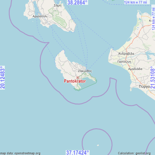
37° 43' 56.676" North, 20° 49' 40.62" East
| Map corner | latitude | longitude |
|---|---|---|
| Upper-left | 38.2864°, | 20.12483° |
| Center: | 37.73241°, | 20.82795° |
| Lower-right: | 37.17424°, | 21.53108° |
| Map W x H: | 123.7×123.7 km | = 76.9×76.9mi |
| max Lat: | 41.72048° ⇑82% North |
| Pantokrátor: | 37.73241° |
| min Lat: | ⇓18% South 34.8346° |
| min Long | Pantokrátor | max Long |
| 19.40494° | 20.82795° | 29.59361° |
| W 6.9%⇐ | ⇒93.1% E |
Elevation
Elevation of Pantokrátor is 54 m = 177 ft, and this is 114.9 m = 377 ft below average elevation for this country.
| Max E: |
1439 m = 4721 ft | 58.7% |
| Avg. | 168.9 m = 554 ft | |
| Pantokrátor | 54 m = 177 ft | |
Min E: |
0 m = 0 ft | 41.3% |
See also: Greece elevation on elevation.city.
Geographical zone
Pantokrátor is located in North temperate zone (between Tropic of Cancer and the Arctic Circle). Distance of this Northern Tropic circle is 1589.5 km =987.7 mi to South.| Distance of | km | miles | from Pantokrátor |
|---|---|---|---|
| North Pole | 5811.6 | 3611.2 | to North |
| Arctic Circle | 3205.7 | 1991.9 | to North |
| Tropic Cancer | 1589.5 | 987.7 | to South |
| Equator | 4195.5 | 2607 | to South |


Nearby cities:
15 places around Pantokrátor: (largest is in red/bold)
• Ambelókipoi
4.8 km =3 mi,  53°
53°
• Gaïtánion
7.7 km =4.8 mi,  31°
31°
• Kalamákion
6.7 km =4.2 mi,  81°
81°
• Kalipádhon
7.7 km =4.8 mi,  6°
6°
• Kallitéros
7 km =4.3 mi,  66°
66°
• Laganás
3.5 km =2.2 mi,  97°
97°
• Lithakiá
1.5 km =0.9 mi,  172°
172°
• Makhairádhon
3.3 km =2.1 mi,  331°
331°
• Mouzaki
0.6 km =0.4 mi,  309°
309°
• Romírion
2 km =1.2 mi, 334°
• Sarakinádhon
6.6 km =4.1 mi,  15°
15°
• Vanáton
7.2 km =4.5 mi, 16°
• Zakynthos
8 km =5 mi, 48°
• Áyios Dhimítrios
7.9 km =4.9 mi,  340°
340°
• Áyios Kírikos
6.2 km =3.9 mi,  2°
2°
Sources, notices
• [Note1] Compared only with cities in Greece existing in our database
• [Src1] Map data: © OpenStreetMap contributors (CC-BY-SA)
• [Src2] Other city data from geonames.org with taken over terms of usage.
• [Src3] Geographical zone / Annual Mean Temperature by Robert A. Rohde @ Wikipedia
