Panagioúda geodata
Panagioúda (North Aegean) is a populated place; located in Greece in Europe/Athens (GMT+3) time zone. With population of 906 people, there are 1124 cities with bigger population in this country. Compared to other cities in Greece, 51.9% of cities are located further ↑North; 97% of cities are located further ←West and 95.6% of cities have higher elevation than Panagioúda. Note1


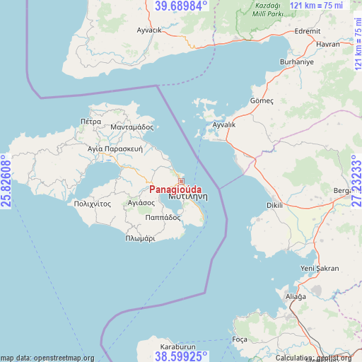
Panagioúda GPS coordinates[2]
39° 8' 47.976" North, 26° 31' 45.12" East
| Map corner | latitude | longitude |
|---|---|---|
| Upper-left | 39.68984°, | 25.82608° |
| Center: | 39.14666°, | 26.5292° |
| Lower-right: | 38.59925°, | 27.23233° |
| Map W x H: | 121.3×121.3 km | = 75.4×75.4mi |
| max Lat: | 41.72048° ⇑51.9% North |
| Panagioúda: | 39.14666° |
| min Lat: | ⇓48.1% South 34.8346° |
| min Long | Panagioúda | max Long |
| 19.40494° | 26.5292° | 29.59361° |
| W 97%⇐ | ⇒3% E |
Elevation
Elevation of Panagioúda is 5 m = 16 ft, and this is 163.9 m = 538 ft below average elevation for this country.
| Max E: |
1439 m = 4721 ft | 95.6% |
| Avg. | 168.9 m = 554 ft | |
| Panagioúda | 5 m = 16 ft | |
Min E: |
0 m = 0 ft | 4.4% |
See also: Greece elevation on elevation.city.
Geographical zone
Panagioúda is located in North temperate zone (between Tropic of Cancer and the Arctic Circle). Distance of this Northern Tropic circle is 1746.8 km =1085.4 mi to South.| Distance of | km | miles | from Panagioúda |
|---|---|---|---|
| North Pole | 5654.4 | 3513.5 | to North |
| Arctic Circle | 3048.5 | 1894.2 | to North |
| Tropic Cancer | 1746.8 | 1085.4 | to South |
| Equator | 4352.7 | 2704.6 | to South |


Nearby cities:
15 places around Panagioúda: (largest is in red/bold)
• Agiásos
15.3 km =9.5 mi,  242°
242°
• Káto Trítos
10.7 km =6.6 mi,  231°
231°
• Loutrá
10.1 km =6.3 mi,  172°
172°
• Mantamádos
24.6 km =15.3 mi,  317°
317°
• Mesagrós
14.2 km =8.8 mi,  210°
210°
• Mytilene
4.9 km =3 mi,  152°
152°
• Mória
1.9 km =1.2 mi, 213°
• Palaiókipos
12.2 km =7.6 mi, 213°
• Pappádos
13.5 km =8.4 mi, 207°
• Plagiá
21.5 km =13.4 mi, 212°
• Plomári
23.4 km =14.5 mi,  215°
215°
• Pámfila
1.3 km =0.8 mi,  330°
330°
• Pérama
11.7 km =7.3 mi,  190°
190°
• Skópelos
14.8 km =9.2 mi, 208°
• Vareiá
8.6 km =5.3 mi, 150°
Sources, notices
• [Note1] Compared only with cities in Greece existing in our database
• [Src1] Map data: © OpenStreetMap contributors (CC-BY-SA)
• [Src2] Other city data from geonames.org with taken over terms of usage.
• [Src3] Geographical zone / Annual Mean Temperature by Robert A. Rohde @ Wikipedia
