Mantamádos geodata
Mantamádos (North Aegean) is a populated place; located in Greece in Europe/Athens (GMT+3) time zone. With population of 1,120 people, there are 900 cities with bigger population in this country. Compared to other cities in Greece, 51.5% of cities are located further ↓South; 95.7% of cities are located further ←West and 67.6% of cities have lower elevation than Mantamádos. Note1


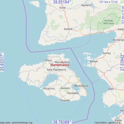
Mantamádos GPS coordinates[2]
39° 18' 36.108" North, 26° 20' 10.644" East
| Map corner | latitude | longitude |
|---|---|---|
| Upper-left | 39.85194°, | 25.63317° |
| Center: | 39.31003°, | 26.33629° |
| Lower-right: | 38.76389°, | 27.03942° |
| Map W x H: | 121×121 km | = 75.2×75.2mi |
| max Lat: | 41.72048° ⇑48.5% North |
| Mantamádos: | 39.31003° |
| min Lat: | ⇓51.5% South 34.8346° |
| min Long | Mantamádos | max Long |
| 19.40494° | 26.33629° | 29.59361° |
| W 95.7%⇐ | ⇒4.3% E |
Elevation
Elevation of Mantamádos is 151 m = 495 ft, and this is 17.9 m = 59 ft below average elevation for this country.
| Max E: |
1439 m = 4721 ft | 32.4% |
| Avg. | 168.9 m = 554 ft | |
| Mantamádos | 151 m = 495 ft | |
Min E: |
0 m = 0 ft | 67.6% |
See also: Greece elevation on elevation.city.
Geographical zone
Mantamádos is located in North temperate zone (between Tropic of Cancer and the Arctic Circle). Distance of this Northern Tropic circle is 1764.9 km =1096.7 mi to South.| Distance of | km | miles | from Mantamádos |
|---|---|---|---|
| North Pole | 5636.2 | 3502.2 | to North |
| Arctic Circle | 3030.3 | 1882.9 | to North |
| Tropic Cancer | 1764.9 | 1096.7 | to South |
| Equator | 4370.9 | 2716 | to South |


Nearby cities:
15 places around Mantamádos: (largest is in red/bold)
• Agía Paraskeví
8.9 km =5.5 mi,  218°
218°
• Dáfia
14 km =8.7 mi,  237°
237°
• Fília
17.7 km =11 mi,  252°
252°
• Kalloní
14 km =8.7 mi,  232°
232°
• Kerámion
15.2 km =9.4 mi, 226°
• Kápi
3.4 km =2.1 mi,  320°
320°
• Míthymna
15.2 km =9.4 mi,  295°
295°
• Mória
25.1 km =15.6 mi,  141°
141°
• Panagioúda
24.6 km =15.3 mi, 137°
• Parákoila
23 km =14.3 mi, 227°
• Pámfila
23.3 km =14.5 mi, 136°
• Pétra
13.9 km =8.6 mi,  277°
277°
• Skalokhóri
23.2 km =14.4 mi,  255°
255°
• Skoutáros
17.5 km =10.9 mi, 263°
• Stýpsi
10 km =6.2 mi,  270°
270°
Sources, notices
• [Note1] Compared only with cities in Greece existing in our database
• [Src1] Map data: © OpenStreetMap contributors (CC-BY-SA)
• [Src2] Other city data from geonames.org with taken over terms of usage.
• [Src3] Geographical zone / Annual Mean Temperature by Robert A. Rohde @ Wikipedia
