Panaitólion geodata
Panaitólion (West Greece) is a populated place; located in Greece in Europe/Athens (GMT+3) time zone. With population of 2,935 people, there are 359 cities with bigger population in this country. Compared to other cities in Greece, 60.2% of cities are located further ↑North; 83.8% of cities are located further →East and 63.6% of cities have higher elevation than Panaitólion. Note1
Administrative division(s):
- Level 1: West Greece
- Level 2: Nomós Aitolías kai Akarnanías
- Level 3: Dimos Agrinio


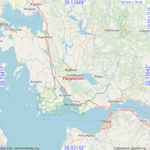
Panaitólion GPS coordinates[2]
38° 34' 59.376" North, 21° 26' 50.244" East
| Map corner | latitude | longitude |
|---|---|---|
| Upper-left | 39.13069°, | 20.74417° |
| Center: | 38.58316°, | 21.44729° |
| Lower-right: | 38.03142°, | 22.15042° |
| Map W x H: | 122.2×122.2 km | = 75.9×75.9mi |
| max Lat: | 41.72048° ⇑60.2% North |
| Panaitólion: | 38.58316° |
| min Lat: | ⇓39.8% South 34.8346° |
| min Long | Panaitólion | max Long |
| 19.40494° | 21.44729° | 29.59361° |
| W 16.2%⇐ | ⇒83.8% E |
Elevation
Elevation of Panaitólion is 42 m = 138 ft, and this is 126.9 m = 416 ft below average elevation for this country.
| Max E: |
1439 m = 4721 ft | 63.6% |
| Avg. | 168.9 m = 554 ft | |
| Panaitólion | 42 m = 138 ft | |
Min E: |
0 m = 0 ft | 36.4% |
See also: Greece elevation on elevation.city.
Geographical zone
Panaitólion is located in North temperate zone (between Tropic of Cancer and the Arctic Circle). Distance of this Northern Tropic circle is 1684.1 km =1046.5 mi to South.| Distance of | km | miles | from Panaitólion |
|---|---|---|---|
| North Pole | 5717 | 3552.4 | to North |
| Arctic Circle | 3111.1 | 1933.1 | to North |
| Tropic Cancer | 1684.1 | 1046.5 | to South |
| Equator | 4290 | 2665.7 | to South |


Nearby cities:
15 places around Panaitólion: (largest is in red/bold)
• Agrínio
5.5 km =3.4 mi,  321°
321°
• Dhokímion
6.7 km =4.2 mi,  300°
300°
• Gavaloú
9.5 km =5.9 mi,  129°
129°
• Grammatikoú
8 km =5 mi,  140°
140°
• Kainoúryion
4.2 km =2.6 mi,  55°
55°
• Kamaroúla
5.2 km =3.2 mi,  358°
358°
• Mataránga
7 km =4.3 mi,  161°
161°
• Megáli Khóra
9.5 km =5.9 mi, 317°
• Néa Avórani
2.8 km =1.7 mi,  0°
0°
• Pandánassa
9.7 km =6 mi,  77°
77°
• Pappadhátai
6.1 km =3.8 mi,  177°
177°
• Paravóla
7.3 km =4.5 mi, 61°
• Triandaíika
9.8 km =6.1 mi,  325°
325°
• Zevgarákion
5.9 km =3.7 mi,  209°
209°
• Áyios Konstandínos
7 km =4.3 mi, 323°
Sources, notices
• [Note1] Compared only with cities in Greece existing in our database
• [Src1] Map data: © OpenStreetMap contributors (CC-BY-SA)
• [Src2] Other city data from geonames.org with taken over terms of usage.
• [Src3] Geographical zone / Annual Mean Temperature by Robert A. Rohde @ Wikipedia
